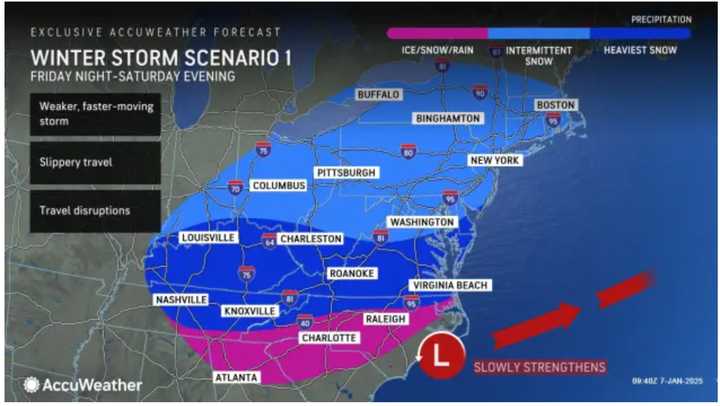
The current projected time frame for the storm is Friday night, Jan. 10, into Saturday evening, Jan. 11, according to the National Weather Service.
Forecast models suggest two primary scenarios for the storm’s path and impact.
"In the first scenario, the heaviest snow is expected to move from the Midwest into the Mid-Atlantic. (See the first image above from AccuWeather.)
The second scenario shows the storm intensifying as it approaches the Northeast, potentially bringing heavy snow to areas shown in the darkest shade of blue. (Click on the second image above.)
"Not only would such a storm bring a substantial amount of snow to cities such as Washington, DC, Baltimore, Philadelphia, New York City, and even Boston from Saturday to Saturday night," said AccuWeather Chief Meteorologist Jonathan Porter, "but it would also increase winds along the coast on par with a major Nor'easter.'"
He added that this scenario is "much less likely -- say only about a 15 percent chance of occurrence -- but still poses enough of a threat to be monitored closely."
"If the storm's path ends up between these two scenarios, it could bring a moderate snowfall and slippery road conditions to Virginia, eastern Maryland, parts of Delaware, South Jersey, Long Island, and Cape Cod from Saturday into Saturday night," AccuWeather notes.
Check back with Daily Voice for updates.
Click here to follow Daily Voice Crofton and receive free news updates.

