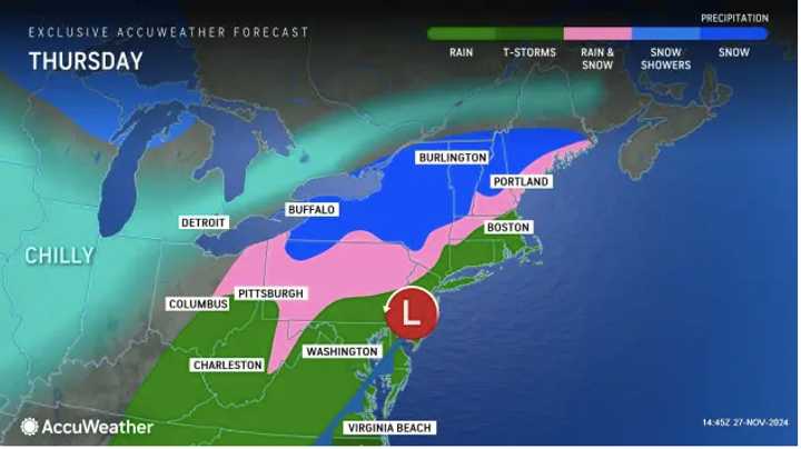
The storm developing Wednesday night, Nov. 27 in the Tennessee Valley will move directly over the region Thanksgiving morning on Thursday, Nov. 28, according to the National Weather Service.
For a look at precipitation types by area, see the first image above from AccuWeather.com: rain and thunderstorms (dark green), rain (green), a mix of rain and snow (pink), and snow (blue).
Heavy downpours are anticipated along the I-95 corridor, with the possibility of steady snowfall in parts of upstate New York, northern Pennsylvania, and New England. (Click on the second image above.)
Snowfall projections have increased, with up to a foot of snow possible in locations in the darkest shade of blue.
In areas in lighter blue, between an inch and a half-foot is expected, where snow and rain could lead to poor visibility and slippery spots, making travel hazardous.
In areas farthest north, the National Weather Service said Wednesday, "While confidence in moderate to heavy precipitation has increased, uncertainty still exists regarding temperatures and resulting rain vs. snow in lower elevations and where the heaviest snow may fall."
Precipitation and low clouds may cause delays at major airports.
After the system moves through, a surge of cold air from Canada will move in, bringing below-average temperatures to the region.
Check back to Daily Voice for updates.
Click here to follow Daily Voice Clarksburg and receive free news updates.

