Tag:

Showers

Separate Rounds Of Showers Will Follow Late Winter Warmup: 5-Day Forecast Separate Rounds Of Showers Will Follow Late Winter Warmup: 5-Day Forecast
Separate Rounds Of Showers Will Follow Late Winter Warmup: 5-Day Forecast Separate rounds of showers will follow a springlike stretch marked by mild temperatures and clear skies. It will be sunny with temperatures above average on Wednesday, March 13, and Thursday, March 14 with high temperatures in the mid-60s on Wednesday and upper 60s on Thursday with calm winds. The first round of showers will move in overnight Thursday into Friday, March 15. Showers will continue through early Friday afternoon on a mostly cloudy day with temps in the 60s. There will be another round of showers early Friday evening. A total of about a quarter of an inch of precipitation is…
New Round Of Scattered Showers, Storms Will Be Followed By Change In Weather Pattern New Round Of Scattered Showers, Storms Will Be Followed By Change In Weather Pattern
New Round Of Scattered Showers, Storms Will Be Followed By Change In Weather Pattern A slow-moving front will spark a new round of scattered showers and thunderstorms that will be followed by a change in the weather pattern. Areas where storm activity is expected on Tuesday, Aug. 23 are shaded in dark green in the first image above from AccuWeather.com. It will be mostly cloudy throughout the day Tuesday with a high temperature in the low 80s.  The most likely time frame for showers and storms is from the early afternoon until the early evening on Tuesday. Skies will gradually clear overnight, leading to a mostly sunny day on Wednesday, Aug. 24 with dry and pleasant …
Pop-Up Storms Possible Before More Widespread System Sweeps Through Region Pop-Up Storms Possible Before More Widespread System Sweeps Through Region
Pop-Up Storms Possible Before More Widespread System Sweeps Through Region Pop-up storms will be possible amid hot, humid conditions this weekend before a more widespread system with the potential for much-needed drenching downpours sweeps through the region. High temperatures will be in the upper 80s to low 90s on Saturday, Aug. 20 under mostly sunny skies, according to the National Weather Service.  Clouds will increase in the afternoon, and isolated showers and thunderstorms are also possible during the afternoon and evening. Sunday, Aug. 21 will be partly sunny with a high temperature in the mid 80s.  There will be a chance for scattered showe…
New Round Of Stray Storms Possible Before Change Heading Into Weekend New Round Of Stray Storms Possible Before Change Heading Into Weekend
New Round Of Stray Storms Possible Before Change Heading Into Weekend A new round of scattered showers and storms is possible before skies clear heading into the weekend. Thursday, July 14 will be partly sunny and warm with a high temperature in the mid to upper 80s. Stray showers and isolated thunderstorms are possible, mainly this afternoon. A few storms may produce strong gusty winds. Skies will gradually become mostly clear overnight, leading to a sunny and pleasant day on Friday, July 15 with a high temperature in the mid 80s. Saturday, July 16 will be mostly sunny, with a high temperature in the mid 80s. More unsettled weather could return Sunday, J…
Here's When New Rounds Of Showers, Storms Are Possible Here's When New Rounds Of Showers, Storms Are Possible
Here's When New Rounds Of Showers, Storms Are Possible New rounds of scattered showers and storms are possible over the next 48 hours. Wednesday, July 13 will be mostly sunny and warm, with a high temperature in the upper 80s to around 90 degrees. The heat index will be in the low to mid 90s, according to the National Weather Service. Pop-up showers and thunderstorms are possible Wednesday evening and into the overnight. Thursday, July 14 will be partly sunny with a high temperature in the mid to upper 80s.  Scattered showers and thunderstorms will arrive in the mid-afternoon, with the window for storm activity lasting until the lat…
Start Of Summer Will Bring Change In Weather Pattern Start Of Summer Will Bring Change In Weather Pattern
Start Of Summer Will Bring Change In Weather Pattern Change is in the air as summer officially starts. The most notable change in the weather pattern will be the increase in moisture, according to AccuWeather Senior Meteorologist Dan Pydynowski. The mainly dry stretch will be followed by scattered showers on the first day of summer on Tuesday, June 21, which will also usher in the start of more humid air through the end of the week. Tuesday will be a partly sunny day with a high temperature in the low 70s, and the chance for showers starting in the mid-afternoon, and continuing through Tuesday evening. Areas most likely to see showers are s…
Stormy Stretch Coming With Separate Rounds Of Thunderstorms: Here's What To Expect Stormy Stretch Coming With Separate Rounds Of Thunderstorms: Here's What To Expect
Stormy Stretch Coming With Separate Rounds Of Thunderstorms: Here's What To Expect A stretch of dry and seasonable weather will be followed by an unsettled weather pattern that will bring multiple rounds of showers and thunderstorms to the region. After a partly sunny day on Tuesday, June 7 with a high temperature in the mid 70s, showers will arrive in the evening, followed by scattered thunderstorms overnight into Wednesday morning, June 8, according to the National Weather Service. Showers and storms will taper off by late Wednesday morning. Wednesday's high temperature will be in the upper 70s. Precipitation is expected to return overnight with a new round of sca…
Summer-Like Stretch Will Be Followed By New Round Of Storms, Shift In Temperatures Summer-Like Stretch Will Be Followed By New Round Of Storms, Shift In Temperatures
Summer-Like Stretch Will Be Followed By New Round Of Storms, Shift In Temperatures A summer-like surge of warm air will be followed by a new round of showers and thunderstorms that will lead to another shift in temperatures. Memorial Day, Monday, May 30 will be mostly sunny with temperatures in the mid 80s, according to the National Weather Service. It will be even warmer on Tuesday, May 31, with the high expected to hit the 90-degree mark in most areas. "While it will be hot for many folks by Monday, any record-challenging heat holds off until Tuesday when the core of the warmth shifts overhead," said AccuWeather Meteorologist Matt Benz. An unsettled stretch …
Unsettled Weather Pattern Arrives In Region: Here's What To Expect, How Long It Will Linger Unsettled Weather Pattern Arrives In Region: Here's What To Expect, How Long It Will Linger
Unsettled Weather Pattern Arrives In Region: Here's What To Expect, How Long It Will Linger An unsettled weather pattern has arrived in the region, with rain or showers expected each day through the start of the weekend. Tuesday, April 5 will be mostly cloudy with a high temperature in the mid to upper 50s with rain and showers arriving sometime around nightfall, according to the National Weather Service. Rain will continue at times overnight and through the mid-afternoon on Wednesday, April 6, which will see a high temperature in the low 50s. After a brief break from the precipitation in the afternoon, more showers are possible Wednesday night. Thursday, April 7 will be cloudy w…
Storm System Will Be Followed By Big Change In Weather Pattern Storm System Will Be Followed By Big Change In Weather Pattern
Storm System Will Be Followed By Big Change In Weather Pattern A new winter storm that will bring a mix of snow, sleet, rain, and showers to the Northeast will be followed by a big change in the weather pattern. 
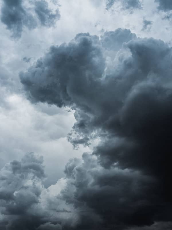
The storm system, due to arrive in this region after midnight Sunday morning, March 6, with its center now expected to be farther north and east. (See the image above.) "In the Northeast, the majority of ice or a wintry mix will generally be confined to upstate New York and central and northern New England with rain forecast for Pittsburgh, New York City, Hartford, Connecticut, and Boston," said AccuWeather Senior Meteorologist Bill Deger.…
New Round Of Thunderstorms Will Usher In Change In Weather Pattern New Round Of Thunderstorms Will Usher In Change In Weather Pattern
New Round Of Thunderstorms Will Usher In Change In Weather Pattern A new round of showers and thunderstorms will lead to a change in the weather pattern. There will be a mix of sun and clouds on Monday, Sept. 27 which will be the warmest day of the week, with the high temperature climbing to the upper 70s after a brisk start to the day. The chance for showers starts overnight heading into Tuesday morning, Sept. 28. It will be mostly cloudy throughout the day, with a high temperature in the low 70s and a chance for showers and storms. The storm chance will increase in the late afternoon and into Tuesday evening and the early overnight hours. After the sy…
Here Comes Fred: Storm Will Bring Downpours, Localized Flooding, Isolated Tornadoes Possible Here Comes Fred: Storm Will Bring Downpours, Localized Flooding, Isolated Tornadoes Possible
Here Comes Fred: Storm Will Bring Downpours, Localized Flooding, Isolated Tornadoes Possible The remnants of Fred, which is now a Post-Tropical Cyclone, will bring locally heavy rainfall and localized flash flooding to the region, with isolated tornadoes possible. The time frame for the main brunt of storm activity in the area will be Wednesday night, Aug. 18 into around noontime Thursday, Aug. 19. For a look at the latest projected track and timing for Fred, see the first image above. The highest chance for flooding will be to the north and west. (Click on the second image above.) Generally, 1 to 2 inches of rainfall is now expected in this area, with locally high…
New Round Of Showers, Thunderstorms Will Be Followed By Change In Weather Pattern New Round Of Showers, Thunderstorms Will Be Followed By Change In Weather Pattern
New Round Of Showers, Thunderstorms Will Be Followed By Change In Weather Pattern An approaching cold front will trigger a new round of showers and thunderstorms will be followed by a change in the weather pattern. Tuesday, July 27 will be warm with a hazy mix of sun and clouds. The high temperature will be in the upper 80s. Scattered storms will arrive late in the evening and continue into the overnight. A few storms may be severe with strong to damaging winds, the National Weather Service said in a Hazardous Weather Statement issued early Tuesday morning. The highest likelihood for storms is in areas farther north. (Areas in dark green in the image above.) Then comes…
New Round Of Showers, Thunderstorms Will Bring Big Change In Weather Pattern New Round Of Showers, Thunderstorms Will Bring Big Change In Weather Pattern
New Round Of Showers, Thunderstorms Will Bring Big Change In Weather Pattern An approaching cold front will trigger a new round of showers and thunderstorms that will be followed by a big change in the weather pattern. Tuesday, July 20 will be hot, and humid, with spotty storms farther north and inland. (See the first image above.) The high temperature will be in the mid to upper 80s with hazy sunshine. Showers and thunderstorms will become widespread throughout the region on Wednesday, July 21.  Storms will arrive late in the morning as the cold front nears. (Click on the second image above.) Some of the storms could produce gusty winds.  Storm activity…
Topsy-Turvy Weather Pattern Will Take Another Turn Starting This Weekend Topsy-Turvy Weather Pattern Will Take Another Turn Starting This Weekend
Topsy-Turvy Weather Pattern Will Take Another Turn Starting This Weekend A Memorial Day weekend that was more like March than May was followed by a summerlike stretch with high temperatures hitting the 90s. The topsy-turvy weather pattern will take another turn with a return to cooler temperatures starting this weekend and continuing into next weekend, according to AccuWeather. (See the first image above.) Saturday, June 12 will be cloudy with a high temperature in the upper 60s. Showers are possible at times, mainly in the morning. For areas most likely to see showers, click on the second image above. Skies will gradually begin clearing overnight with mostly s…
Line Of Thunderstorms, Some Severe, Sweeping Through Region, With Gusty Winds, Hail Possible Line Of Thunderstorms, Some Severe, Sweeping Through Region, With Gusty Winds, Hail Possible
Line Of Thunderstorms, Some Severe, Sweeping Through Region, With Gusty Winds, Hail Possible A line of thunderstorms, some severe, is sweeping through the region from the west to the east on Tuesday afternoon, June 8. Storm activity is expected to continue through the afternoon and evening. Wind gusts up to 60 miles per hour and penny-sized hail are possible. "There is the potential for heavy rainfall which may produce localized flash flooding," the National Weather Service said in a Hazardous Weather Statement on Tuesday. "Gusty winds and lightning strikes are also threats." Wednesday, June 9 will be another hot, humid, and potentially stormy day, with partly sunn…
Midweek Warmup Will Be Followed By Showery, Stormy Stretch: Here's What Coming Midweek Warmup Will Be Followed By Showery, Stormy Stretch: Here's What Coming
Midweek Warmup Will Be Followed By Showery, Stormy Stretch: Here's What Coming Things will heat up temperature-wise in the middle of the week before a dreary, showery, and stormy stretch of days. After a cloudy start on Tuesday, April 27, skies will become partly cloudy. The high temperature will be in the mid 60s. The warmup arrives on Wednesday, April 28 as the high temperature will hit 80 degrees in most of the region under partly sunny skies with calm winds. Clouds will thicken Wednesday night and there will be isolated showers overnight. Thursday, April 29 will be cloudy and breezy with showers at times during the day and a chance of thunderstorms in the mid to…
Storm System Will Sweep Through Region, Leading To Change In Weather Pattern Storm System Will Sweep Through Region, Leading To Change In Weather Pattern
Storm System Will Sweep Through Region, Leading To Change In Weather Pattern A new storm system will sweep through the region, leading to a change in the weather pattern. Wednesday, Sept. 2 has started off with morning showers and patchy fog. There will be a break in the showers during the afternoon on a day in which the high temperature will be in the upper 70s. As a frontal boundary approaches during the evening, a round of isolated thunderstorms will move in after 10 p.m. Wednesday. The passage of the storm system will lead to an increase in temperatures on Thursday, Sept. 3, which will be a partly sunny and warmer day with the high temp around 85 deg…
Stormy Stretch Will Lead To Gradual Drop In Temperatures, Less Humidity Stormy Stretch Will Lead To Gradual Drop In Temperatures, Less Humidity
Stormy Stretch Will Lead To Gradual Drop In Temperatures, Less Humidity A cold front slowly moving through the region will bring thunderstorms and showers, leading to a gradual reduction in temperatures after several days of dangerous heat. Scattered thunderstorms and showers that could be accompanied by heavy downpours will arrive in the region Wednesday afternoon, Aug. 12, starting a stretch of stormy weather. After patchy morning fog to start the day Wednesday, the chance for thunderstorms and showers starts at around 3 p.m. and continues through the afternoon and into the evening, up until around 9 p.m. The high temperature Wednesday will be in the upper 8…