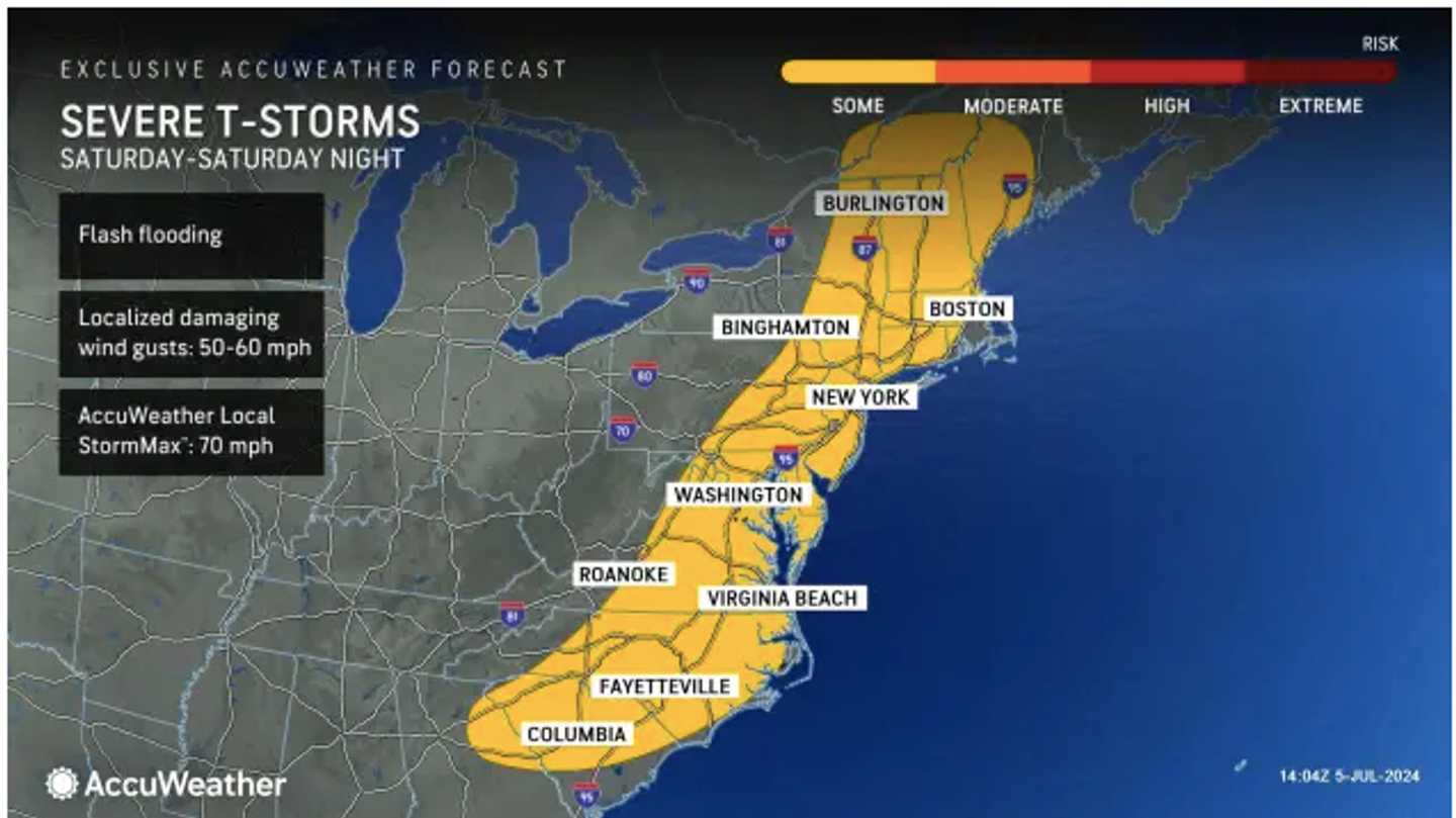

The main threats will be downpours, which could lead to flash flooding, and wind gusts of 50 miles per hour or higher. Large hail and isolated tornadoes are possible. (See the first image above from AccuWeather.com.)
Storm activity could continue into the early morning hours of Sunday, July 7.
A radar view from the National Weather Service of the Northeast (shown in the second image above) shows the scattered activity early Saturday evening, July 6, with severe storms marked in red.
After patchy morning fog on Sunday morning, July 7, skies will become partly to mostly sunny. It will remain humid with a high temperature of around 90 degrees and heat index values in the mid to upper 90s.
Monday, July 8, will be less humid, but the mercury is expected to once again hit 90 degrees.
It will be partly sunny most of the day on Tuesday, July 9 with temperatures in the upper 80s. A return of humid air will lead to a chance of late afternoon and evening showers and thunderstorms.
The outlook for Wednesday, July 10 calls for mostly cloudy skies, high temperatures in the upper 80s, and another chance for afternoon and evening storms.
Check back to Daily Voice for updates.
Click here to follow Daily Voice Hampshire Franklin and receive free news updates.