Find Your Daily Voice
 45°
45°
Tag: Winter Weather Advisory
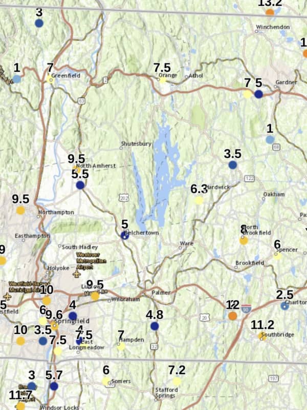
Storm Bringing Snow, Ice, 30 MPH Winds Takes Aim On Western Mass
A potent, fast-moving storm will bring a mix of snow, significant icing, heavy rain, and damaging gusty winds is taking aim on the Northeast and Massachusetts.
The time frame for the storm is after nightfall Sunday, Jan. 16 into Monday afternoon, Jan. 17 on Martin Luther King Jr. Day.
A Winter Weather Advisory is in effect for Central and Western Massachusetts from midnight to 7 a.m. Monday.
After a frigid start with single-digit temperatures in the morning, Sunday's high will rebound in the afternoon and reach the low 30s, but strong winds will make it feel much cold, and clouds will…
Quick-Moving Storm System Will Bring Wintry Mix, Freezing Rain To Region
Get set for another round of wintry weather.
A Winter Weather Advisory is in effect across the interior portions of the region from 4 p.m. Monday, Dec. 27 to 7 a.m. Tuesday, Dec. 28 for most of the region, and until 10 a.m. Tuesday for northern Connecticut and Massachusetts.
A light wintry mix could leave a glaze of ice in these areas, according to the National Weather Service.
For New York City, Long Island, and coastal Westchester and Connecticut, where the advisory is not in effect, spotty light snow or sleet will become plain rain in the evening, the weather service said.
There will b…