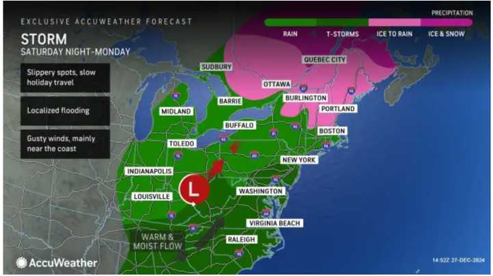
Widespread heavy rain is expected at times Saturday night, Dec. 28 with a mix of rain and showers overnight heading into Sunday morning, Dec. 29, according to the National Weather Service.
Overnight temperatures will hold steady and remain well above freezing.
Localized flooding is most likely in areas farthest south into Monday, Dec. 30 (shown in dark green in the first image above from AccuWeather.)
Areas in the darker shades of green in the second image above from AccuWeather are expected to see the most rainfall through Sunday night, Dec. 29, with 2 to 4 inches of precipitation possible.
Most locations in the Northeast will see between 1 and 2 inches of rainfall during that time.
Temperatures will climb into the 50s Sunday with raining tapering off by around midday. The next round of showers will then come overnight Sunday, into Monday, Dec. 30.
There will be showers at times throughout Monday morning followed by gradual clearing.
Clouds will increase starting after daybreak New Year's Eve Day on Tuesday, Dec. 31, with a new round of rain and showers arriving at night and continuing into the early morning hours of New Year's Day on Wednesday, Jan. 1.
Check back to Daily Voice for updates.
Click here to follow Daily Voice Sheffield-Egremont and receive free news updates.

