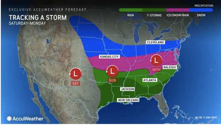
The system will move through the Midwest over the weekend before arriving in much of the Northeast on Monday, Jan. 6, according to the National Weather Service.
Major hubs in the storm’s path for potential snow and ice include New York City, Philadelphia, Pittsburgh, and Baltimore. (See the first image above.)
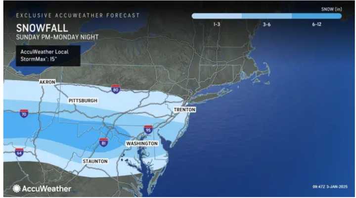
Areas in the lightest shades of blue in the second image above should see between 1 to 6 inches of snowfall, while regions in the darkest blue shade may receive half a foot to a foot of snow.
“Over a dozen states are forecast to be impacted by one or more aspects of this storm,” said AccuWeather Meteorologist Brandon Buckingham.
But there's still uncertainty surrounding the ultimate track of the storm.
Cold air that arrived on Thursday, Jan. 2, will linger into next week.
Check back with Daily Voice for updates.
Click here to follow Daily Voice Sharon and receive free news updates.

