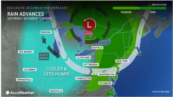
Unsettled conditions will move in during the afternoon with a line of showers and thunderstorms ahead of the front.
The window for storms is from the early afternoon into the early evening on Saturday. Rain could be heavy at times. Showers could linger into the late evening.
About a half-inch of rainfall is expected Saturday, with locally higher amounts.
It will clear out Saturday night, leading to a stretch of dry and comfortable days.
The second half of the weekend will be sunny with plenty of blue skies and a high temperature of around 70 degrees on Sunday, Sept. 8.
It will remain sunny on Monday, Sept. 9, and Tuesday, Sept. 10, with high temperatures in the upper 70s to around 80 degrees.
The outlook for Wednesday, Sept. 11, calls for sunny skies and a high temperature in the low 80s.
Check back to Daily Voice for updates.
Click here to follow Daily Voice Quincy and receive free news updates.
