
It's expected to arrive in the Northeast late Wednesday afternoon, Feb. 19, moving up from the south before winding down around midday on Thursday, Feb. 20, according to the National Weather Service.
Snowfall Projections
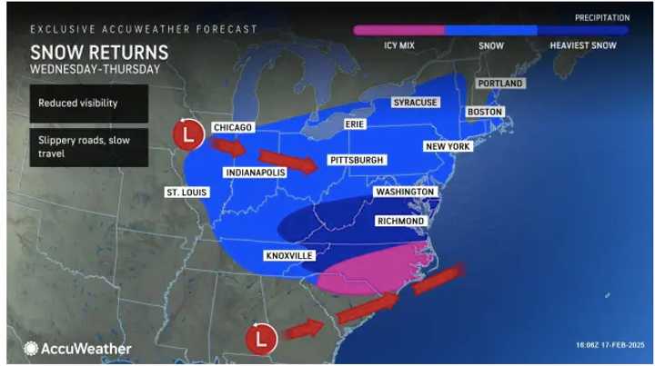
- Areas in the darkest shade of blue in the first image above from AccuWeather could see more than a foot of accumulation, according to the latest predictions released Monday afternoon, Feb. 17.
- Locations in this shade are projected to receive between 6 inches and a foot of snow, with locally higher amounts.
- The next lightest shade predicts 3 to 6 inches of accumulation, while the lightest shade forecasts 1 to 3 inches.
- Current computer models indicate the highest snowfall amounts are expected in the mid-Atlantic region. (Click on the second image above)
Potential for Change
Any change in the storm’s projected track could mean heavier snowfall farther north into cities like Philadelphia, New York, and Boston.
AccuWeather Senior Meteorologist Kerry Schwindenhammer noted, “Snowfall accumulations in the Northeast, especially in New England, will be heavily dependent on the storm’s track. A sharper turn up the coast could lead to higher amounts for places as far north as Boston, Providence, Rhode Island, and even Portland, Maine.”
A blast of Arctic air, bringing temperatures 10 to 25 degrees below seasonal averages, will set the stage for this winter storm.
Impact on Travel
“The timing of the snow in parts of the Interstate 95 corridor on Wednesday afternoon may be particularly challenging,” said AccuWeather Senior Meteorologist Courtney Travis. “Snow arriving in the afternoon in places like Washington and Baltimore could lead to rapidly deteriorating travel conditions going into the afternoon and evening commute.”
Check back to Daily Voice for updates.
Click here to follow Daily Voice Pepperell-Townsend and receive free news updates.