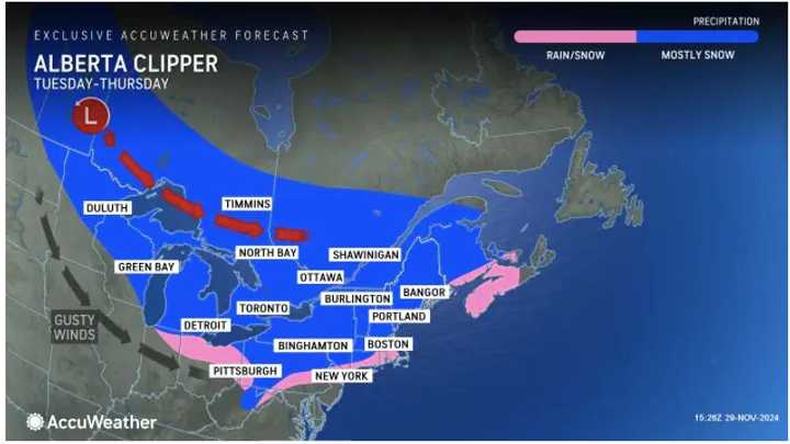
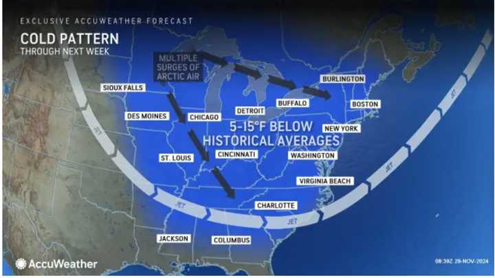
"These storms will briefly disrupt the lake-effect snow machine and bring more widespread accumulations of a coating to a few inches," according to AccuWeather.
Blasts of cold conditions will arrive overnight Friday, Nov. 29 into Saturday, Nov. 30, with temperatures dipping into the upper 20s, according to the National Weather Service.Saturday will be sunny, with a high temperature of around 40 degrees. But it will feel colder, with wind gusts between 20 and 25 miles per hour.
As the calendar flips to December, Sunday, Dec. 1, will remain sunny and brisk, with temperatures ranging from the upper 30s to the low 40s.
Look for more of the same on Monday, Dec. 2, with mainly sunny skies and a high temperature generally around 40 degrees.
Tuesday, Dec. 3's outlook calls for mostly sunny skies and temperatures in the upper 30s to low 40s.
Tuesday will mark the start of a string of three days in areas shown in pink and blue in which the clipper systems with fast-falling snowfall starts. (See the first image above from Accuweather.)
Check back to Daily Voice for updates.
Click here to follow Daily Voice Ludlow and receive free news updates.

