AccuWeather’s long-range experts say that a weakening polar vortex will bring unseasonably cool conditions this week.
The shift is expected to increase chances of rain and snow across the Northeast.
Sunday, March 23, marks the start of the stretch of days with below average temps.
"Overall, we’re expecting temperatures to be 5-10 degrees below the historical average as a whole for the end of March." AccuWeather Lead Long-Range Expert Paul Pastelok said.
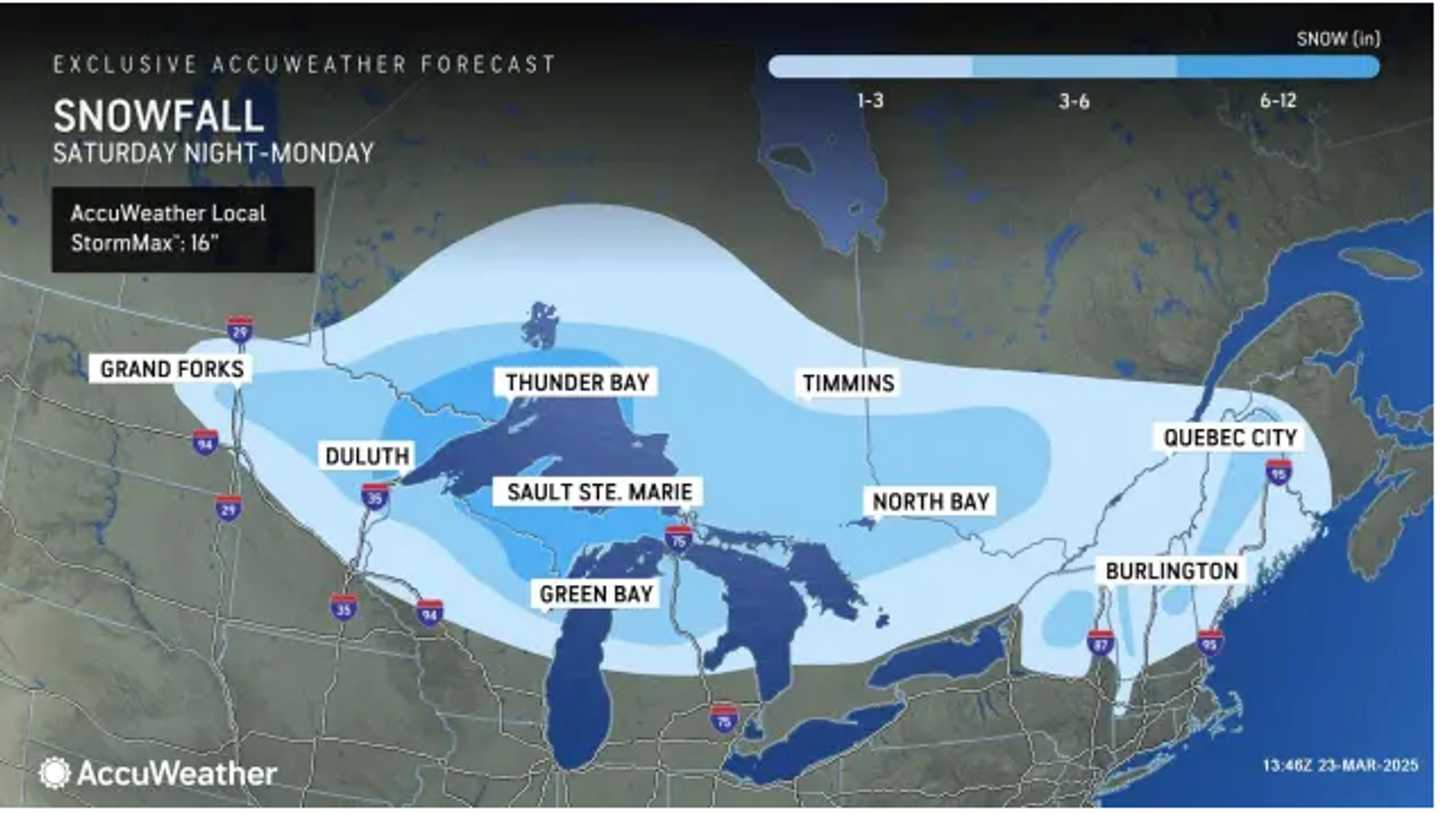
The first storm of the week, moving from the upper Midwest, will bring a wintry mix to areas in the Northeast generally north of the I-84 corridor overnight Sunday into Monday, March 24, the National Weather Service says.
Refer to the image above to see locations in upstate New York and northern New England where up to a half-foot of accumulation is possible.
Rain is expected along the I-95 corridor.
Then, a separate system Tuesday night, March 25 into Wednesday, March 26 will bring widespread rain and showers and accumulating snow to parts of the Appalachians.
"The pattern heading into April favors wetness and cooldowns across the East," Pastelok said.
Check back to Daily Voice for updates.
Click here to follow Daily Voice Franklin and receive free news updates.