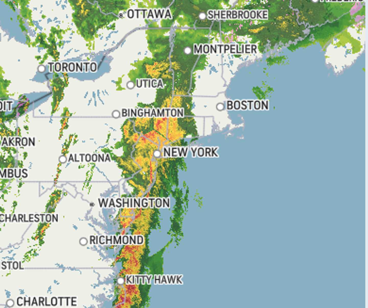

The sprawling system arrived Wednesday afternoon, March 5. A radar image of the East Coast above from around 6:30 p.m. shows areas where there are thunderstorms (in orange) and heavy rain (in yellow).
Wind gusts will reach 40 to 50 miles per hour across a broad area in the Midwest and along the East Coast. (Click on the second image above from AccuWeather.)
Precipitation will taper off overnight into the early morning hours of Thursday, March 6, as winds gradually weaken.
Generally, about 1 inch of rainfall is expected, with locally higher amounts of up to 2 inches or more in areas where thunderstorms develop.
Check back to Daily Voice for updates.
Click here to follow Daily Voice Bellingham and receive free news updates.