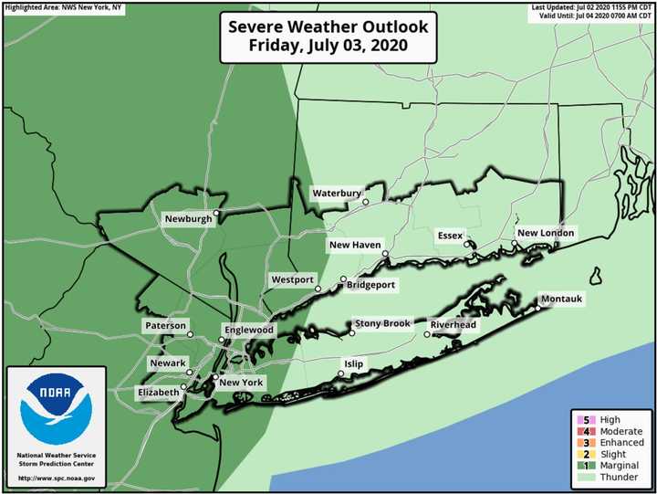
Storms should occur in the middle to late afternoon and into the evening on Friday, July 3 with the primary threat being damaging wind gusts.
There is also the potential for localized flash flooding, the National Weather Service said in a Hazardous Weather Outlook statement issued early Friday morning.
The greatest threat will be in areas north and west of New York City. (See image above.)
Additionally, the National Weather Service Storm Prediction Center has placed the Hudson Valley, Northeast New Jersey, southwest Connecticut, and far western Long Island under a marginal risk for severe weather.
The time frame for storm activity is from around 4 p.m. to 11 p.m. Friday, which will be hazy, hot and humid with the high temperature in the upper 80s.
Independence Day, Saturday, July 4th will be mostly sunny with the high temperature in the low 80s.
Check back to Daily Voice for updates.
Click here to follow Daily Voice Torrington and receive free news updates.
