

The heaviest rain and strongest winds are expected to arrive just after nightfall on Tuesday, Jan. 9, and continue into the early overnight hours on Wednesday, Jan. 10.
High wind and flood watches have been issued throughout the region.
Melting snow in areas where there were snowfall totals ranging from a couple of inches to a foot or more of accumulation, combined with drenching downpours, is expected to compound flooding and lead to possible road and parkway closures.
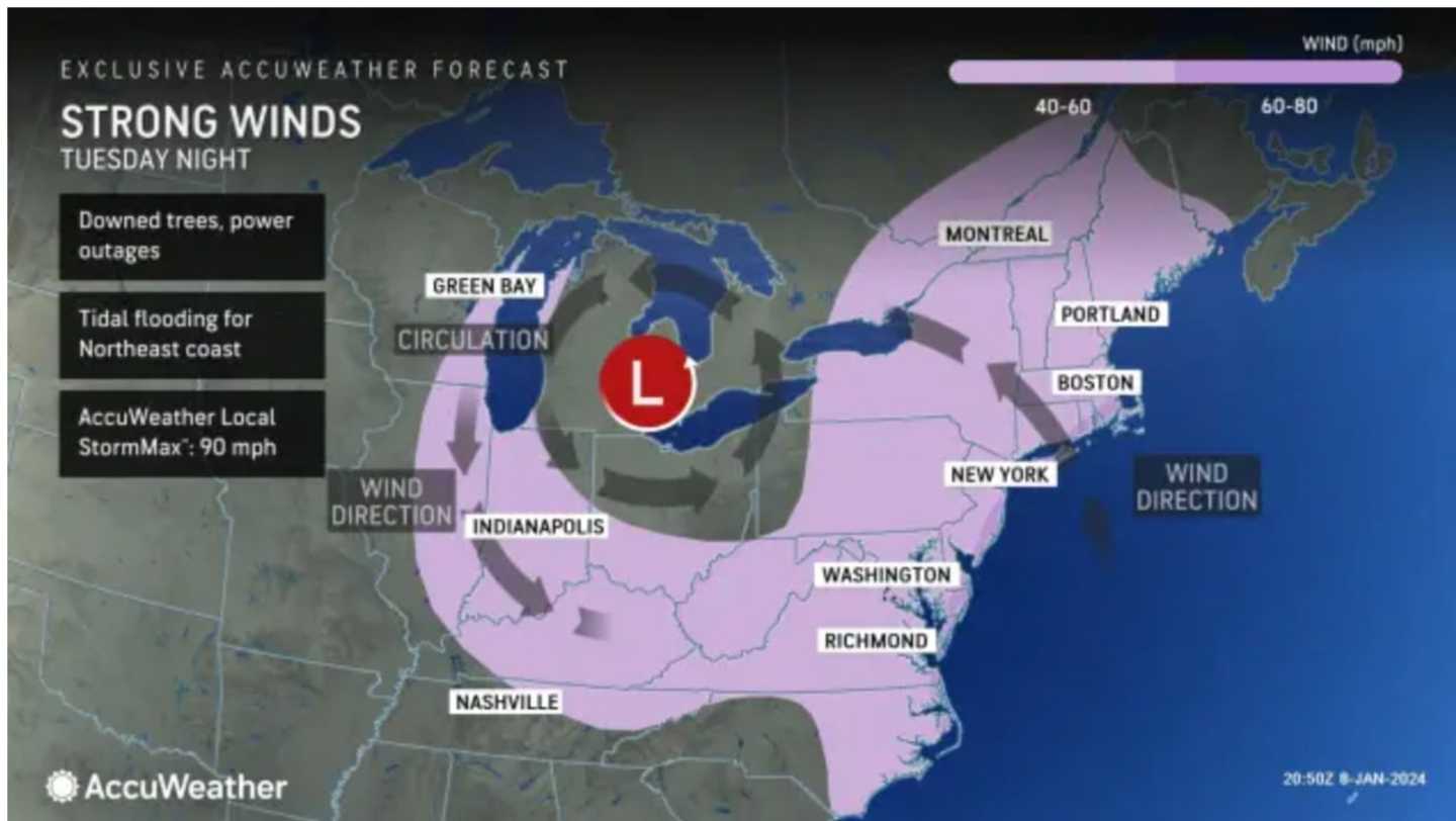
In addition, widespread wind gusts of 40 to 50 miles per hour and higher are expected, with gusts as high as 65 mph or more in some spots. (See the first image above from AccuWeather.com.)
Rain will become heavy Tuesday night with between 2 and 4 inches of rainfall possible into midday on Wednesday with breezy conditions lingering. Click on the second image above to see where the highest rainfall amounts are expected.
It will be cloudy throughout the day Tuesday with a high temperature in the mid to upper 40s.
Rain will mix with sleet and snow in upstate New York and northern New England Tuesday night into Wednesday with generally 1 to 3 inches of snowfall accumulation expected, and up to 6 inches in some of those areas. (Click on the third image above for the latest projections from AccuWeather.com.)
Heavy rain is now expected to wind down by around daybreak Wednesday, followed by a chance of showers, and then gradual clearing later in the afternoon. It will remain breezy with wind gusts as high as 30 mph at times.
Thursday, Jan. 11 and Friday, Jan. 12 will be mainly sunny with a high temperature in the low 40s on both days.
The outlook for Friday, Jan. 12 calls for partly sunny skies with a high temperature in the mid to upper 40s.
Unsettled conditions are expected to return Friday evening with rainfall arriving and continuing on Saturday, Jan. 13. The high temperature will be in the low 50s.
Check back to Daily Voice for updates.
Click here to follow Daily Voice Torrington and receive free news updates.