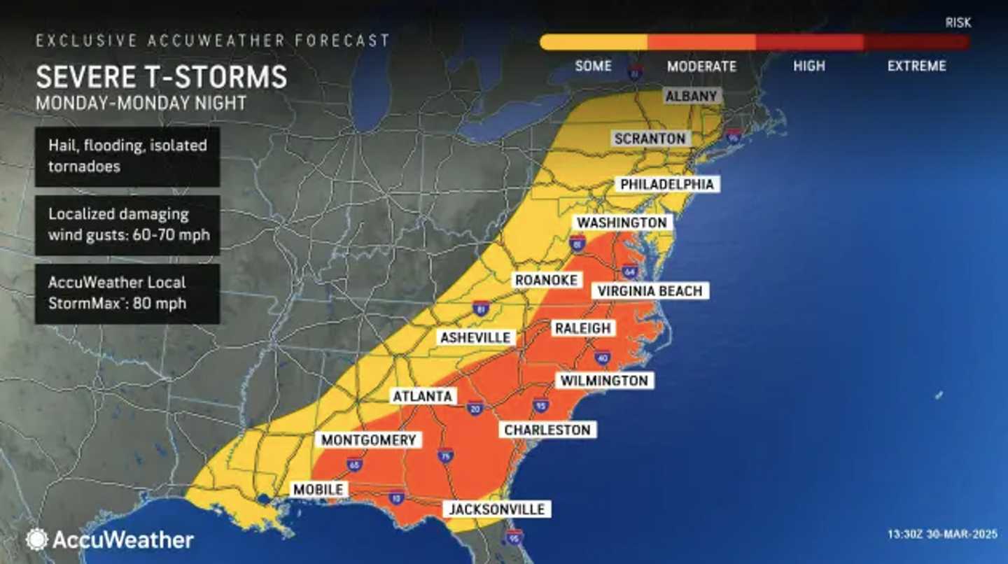
A warm front will arrive overnight from Sunday, March 30, into Monday, March 31, bringing rounds of stormy weather from northern Florida to parts of New England.
Areas highlighted in orange on the AccuWeather map show regions most at risk for severe thunderstorms, especially in the Mid-Atlantic and South. Damaging wind gusts will be the primary threat.
Minor flooding is possible in some areas, particularly on roads and low-lying properties such as parking lots, parks, and basements near bodies of water, the National Weather Service warned.
Showers and storms will return Monday evening as a new frontal system, this time a cold front, pushes through.
Clearing will follow as April begins on Tuesday, April 1, with sunshine and seasonable temperatures expected.
Check back to Daily Voice for updates.
Click here to follow Daily Voice Plainville and receive free news updates.