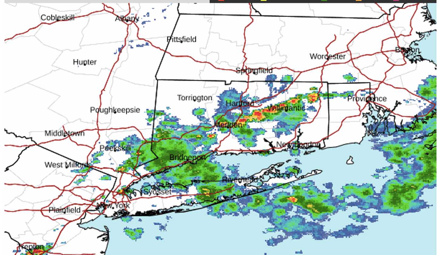
A radar image of the region above at around 3 p.m. Monday, Sept. 1 shows the severe storms marked in red, and orange.
Heavy downpours have been repeated in some spots.
Storm activity is expected to wind down by late Sunday afternoon.
Labor Day on Monday, Sept. 2, will be mostly sunny, with high temperatures in the mid-70s and comfortable conditions for the unofficial end of summer. (See the image above from AccuWeather.com.)
The overnight low temperature will have a fall-like feel, dropping to the low 50s in much of the region.
Check back to Daily Voice for updates.
Click here to follow Daily Voice Norwich and receive free news updates.