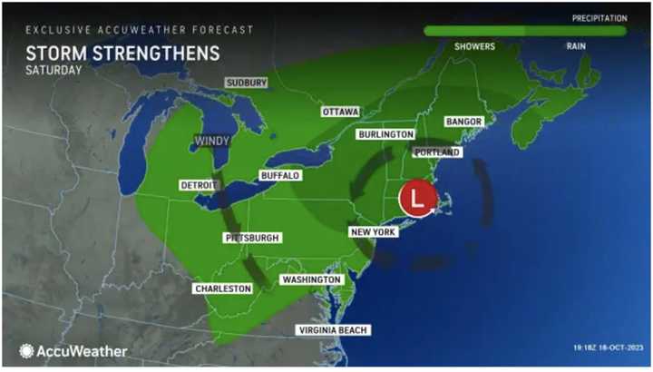
The current projected possible time frame for the Nor’easter is overnight Friday, Oct. 20, through Saturday, Oct. 21 with the windy conditions persisting on Sunday, Oct. 22.
"The brunt of the storm will be delivered in New England and the Canadian Maritimes, but impacts will be felt elsewhere in the Northeast with some showers and gusty winds predicted," according to AccuWeather.com.
There will be a mix of clouds and sun on Thursday, Oct. 19, according to the National Weather Service, The high temperature will be in the low 60s.
Friday will be cloudy with a high temperature in the mid-60s with rain and scattered showers moving from west to east starting in the mid-morning and continuing throughout the day.
Rain will be heavy at times, and gusty winds, especially in areas farther east, where up to 4 inches of rainfall. is possible in parts of New England, eastern Quebec, and New Brunswick.
For other locations in the Northeast, the wettest period will be from Friday to Saturday, when motorists and pedestrians may face flooding in poor drainage areas and difficulties commuting, AccuWeather.com said.
Precipitation should wind down overnight Saturday into Sunday, Oct. 22, which will gradually become partly sunny, according to the National Weather Service.
Sunday's high temperature will be in the mid-50s but breezy conditions and strong wind gusts will make it feel cooler.
Some uncertainty remains surrounding the track, timing, and strength of the weekend storm system.
Check back to Daily Voice for updates.
Click here to follow Daily Voice New Haven and receive free news updates.
