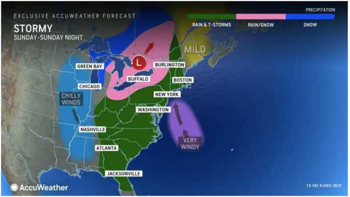
The wide-ranging system will move in on Sunday, Dec. 10, and continue into Monday, Dec. 11.
"The highest chance of accumulating snow will be in parts of the Appalachians and the interior Northeast as the cold air rushes in behind a strong cold front Sunday afternoon into Sunday night," according to AccuWeather Meteorologist La Troy Thornton.
Areas in green in the image above will see rainfall with snow expected in those parts of the Northeast shown in pink.
Widespread wind gusts of 40 to 50 miles per hour are expected Sunday into Monday, Dec. 11, with stronger gusts up to 60 miles per hour farther east, and up to 70 mph along the New England coast. (Click on the second image above.)
Friday, Dec. 8 will start with mostly sunny skies before clouds increase in the afternoon. The high temperature will generally be in the mid-40s.
The day before the storm arrives, Saturday, Dec. 9, the mercury will climb to a high temperature in the mid-50s with partly sunny skies.
Sunday will be mostly cloudy and breezy throughout the day. The chance for rainfall will start in the early afternoon.
Current projections for the storm system predict the heaviest rainfall and strongest wind gusts Sunday evening and continuing overnight into Monday before the system moves out Monday night.
"Travelers both on the roads and in the air could end up experiencing delays, even in areas where rain or snow is not falling," AccuWeather.com says.
Check back to Daily Voice for updates.
Click here to follow Daily Voice New Haven and receive free news updates.

