Temperatures will begin to trend upward after a weekend marked by frigid conditions, according to the National Weather Service.
On Sunday, Jan. 21, the mercury will reach the upper 20s, and skies will become clear, with plenty of sun amid blustery conditions and wind-chill values in the single digits.
It will remain cold and dry on Monday, Jan. 22 with sunny skies and a high temperature in the mid-30s.
Clouds will increase Monday night ahead of the arrival of the stormy weather pattern on Tuesday, Jan. 23.
It will be cloudy during the day with a high temperature climbing to around 40 degrees before a storm system pushes through at night bringing snow inland, with a mix of snow and rain elsewhere.
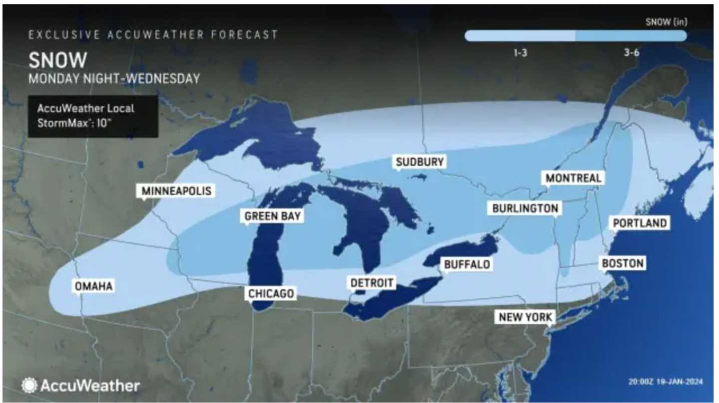
Parts of upstate New York and northern New England could see up to 6 inches of snowfall. (Shown in the darkest shade of blue in the image above from AccuWeather.com.)
The mix of rain and snow will turn to all rain later in the morning on Wednesday, Jan. 24 as the high temperature reaches 40 degrees.
Rain will continue at times during the afternoon and into Wednesday evening as well as during the day on Thursday, Jan. 25.
Check back to Daily Voice for updates.
Click here to follow Daily Voice New Haven and receive free news updates.