The storm, which is accompanying a cold front, is moving from the east on Tuesday night, Dec. 10, into Wednesday, Dec. 11, according to the National Weather Service.
During the storm's height, there will be heavy rain and wind gusts between 25 and 30 miles per hour.
Some areas, especially along coastal areas of the Northeast, could see gusts of between 50 and 70 mph and are where outages are most likely. They are displayed in orange in the first image above from AccuWeather. Other locations where outages are possible are displayed in yellow.
Click on the second image above to see areas where wind gusts of 50 miles per hour or more are possible.
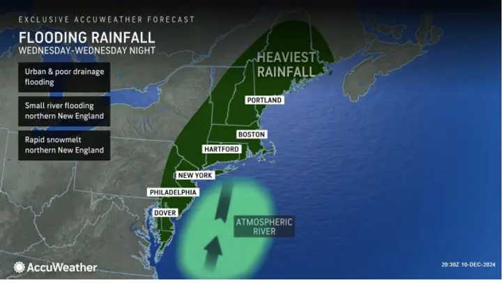
The storm will bring widespread rainfall of 1 to 2 inches, with 2 to 4 inches in the areas indicated by the darker shade of green in the second image above from AccuWeather.com in projections released Tuesday. (Click on the third image above for projected rainfall amounts).
“An intense band of rain may develop with gusty winds that can really hamper travel during the afternoon and evening commutes on Wednesday from the Carolinas to southern New England,” AccuWeather Senior Meteorologist Alex Sosnowski said. “Thunder and lightning could accompany the intense rain and urban flooding potential.”
Click on the fourth image above to see locations where flooding is most possible.
Rainfall will begin tapering off Wednesday night, according to the National Weather Service.
After the frontal system pushes through, it will be mostly sunny and colder on Thursday, Dec. 12.
Check back to Daily Voice for updates.
Click here to follow Daily Voice Mystic and receive free news updates.


