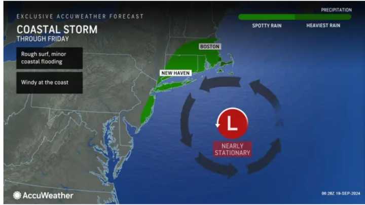
But some parts of the region farthest west could avoid precipitation from the system on Thursday night, Sept. 19, and Friday, Sept. 20.
The image above from AccuWeather.com shows areas expected to be affected by the system in green, with the heaviest rain farthest east.
"Some areas that could be drenched by downpours intense enough to trigger urban and flash flooding include Long Island, New York, part of southern New England and perhaps the immediate New Jersey coast," AccuWeather Senior Meteorologist Dave Dombek said.
Thursday will be partly sunny, with high temperatures in the upper 70s.
It will become breezy in the afternoon before the system arrives, with gusts of 20 miles per hour or more.
Precipitation starting at night will continue in the early morning hours of Friday.
Rain and showers will occur at times during the day Friday through Friday night before conditions dry out for the weekend.
Saturday, Sept. 21, will be partly sunny and pleasant, with a high temperature in the low to mid-70s.
On Sunday, Sept. 22, expect a mix of sun and clouds and a high temperature of around 70 degrees.
The outlook for Monday, Sept. 23, calls for sunny skies and a high temperature in the upper 60s.
Check back to Daily Voice for updates.
Click here to follow Daily Voice Ledyard-Preston and receive free news updates.
