The topsy-turvy conditions will include rounds of drizzle, gusty showers, and the threat of severe thunderstorms, heavy rain, ice — and even accumulating snow farthest north, according to AccuWeather.
This pattern is being driven by a series of storms tracking through the region, combined with a sudden wind shift — from the warm, moisture-rich South to the icy grip of the Atlantic and Canada.
These shifts can trigger temperature swings of 10 to 40 degrees Fahrenheit within a matter of hours, even across relatively short distances.
Separate rounds of accumulating snow are expected in parts of upstate New York and northern New England overnight from Sunday, April 6, into Monday morning, April 7 and again Monday night into Tuesday morning, April 8, according to the National Weather Service.
AccuWeather Senior Meteorologist Dave Dombek said the setup resembles last weekend, “where temperatures ranged from the 30s to the 50s, while just outside that chilly wedge, temperatures soared to balmy levels in the 60s, 70s, and 80s.”
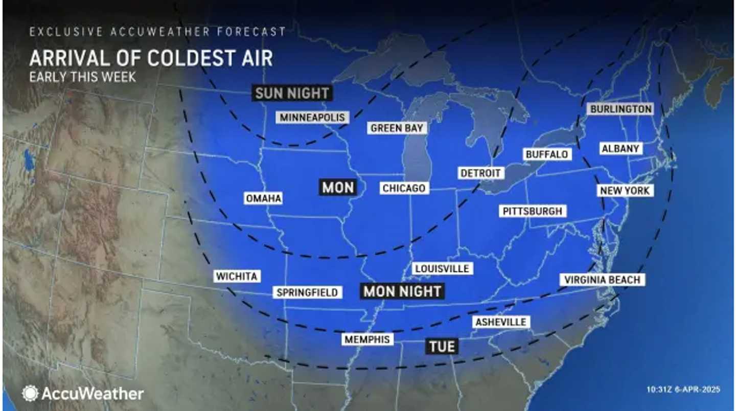
A major alteration in the jet stream is expected to send winter-like conditions back into much of the Northeast.
A polar vortex shift — normally responsible for bottling up the coldest air — has contributed to the region’s recent temperature volatility.
As a result, a southward dip in the jet stream will lead to colder-than-average conditions across much of the region.
For example, while New York City typically sees highs around 60 degrees in early April, forecasts call for several days with highs only in the 40s.
Check back to Daily Voice for updates.
Click here to follow Daily Voice Killingly-Danielson and receive free news updates.