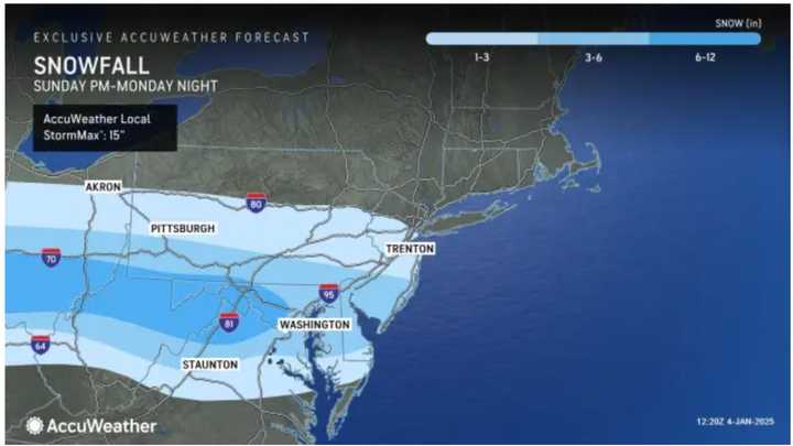
The system will move through the Midwest over the weekend before arriving in the Northeast at the outset of the workweek with most snowfall expected in areas farther south, according to the National Weather Service.
Areas in the lightest shades of blue in the image above should see between 1 to 6 inches of snowfall, while locations in the darkest blue shade may receive half a foot to a foot of snow.
In those areas, snowfall is expected to arrive overnight Sunday, Jan. 5 and linger into Monday night, Jan. 5. Heavy snow is possible at times, a localized band with up to 10 inches of snow is possible, and Winter Storm Watches are in effect in those locations.
Farther north, a coating to 2 inches is possible in New Jersey, New York City, Long Island, the lower Hudson Valley, and coastal Connecticut.
"There is still inherent uncertainty in the exact track of low pressure," the the National Weather Service says, noting "small deviations in track would increase or decrease snowfall amounts by a few inches."
Check back with Daily Voice for updates.
Click here to follow Daily Voice Durham-Middlefield and receive free news updates.
