
The National Weather Service said some storms are expected to be severe on Wednesday, Aug. 28, as heat indices may reach 100 degrees.
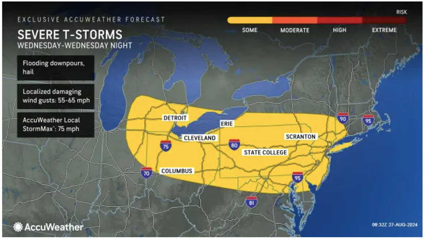
Areas shown in yellow in the first image above from AccuWeather.com are most likely to see the strongest storms.
There will be a break from precipitation on Tuesday, Aug. 27, with sunny and dry conditions and high temperatures in the mid to upper 80s.
On Wednesday, heat indices will be near, at, or slightly above 100 degrees, with high temperatures in the low 90s.
After a mostly sunny start, clouds will increase in the afternoon Wednesday, with the current projected timing for storms starting in the early afternoon and continuing into the evening.
It will be much cooler on Thursday, Aug. 29, with a high temperature in the mid-70s and partly sunny skies. There could be lingering showers and a spotty thunderstorm can't be ruled out.
Friday, Aug. 30, will be the pick of the week weather-wise, with plenty of sunshine and comfortable temperatures in the mid-70s.
It will become overcast during the evening, leading to a cloudy day on Saturday, Aug. 31.
There will be a 50-50 chance for showers during the day and again at night, and the high temperature will be in the mid to upper 70s.
Check back to Daily Voice for updates.
Click here to follow Daily Voice Cheshire and receive free news updates.