Are you concerned about Tropical Storm Hermine?
- Yes
- No
Connecticut residents should also be prepared in case power outages occur due to the storm.
“Our office is receiving real-time updates on this storm and its path. Just as the state is monitoring and preparing, the public should do the same, especially residents in our shoreline communities,” Malloy said.
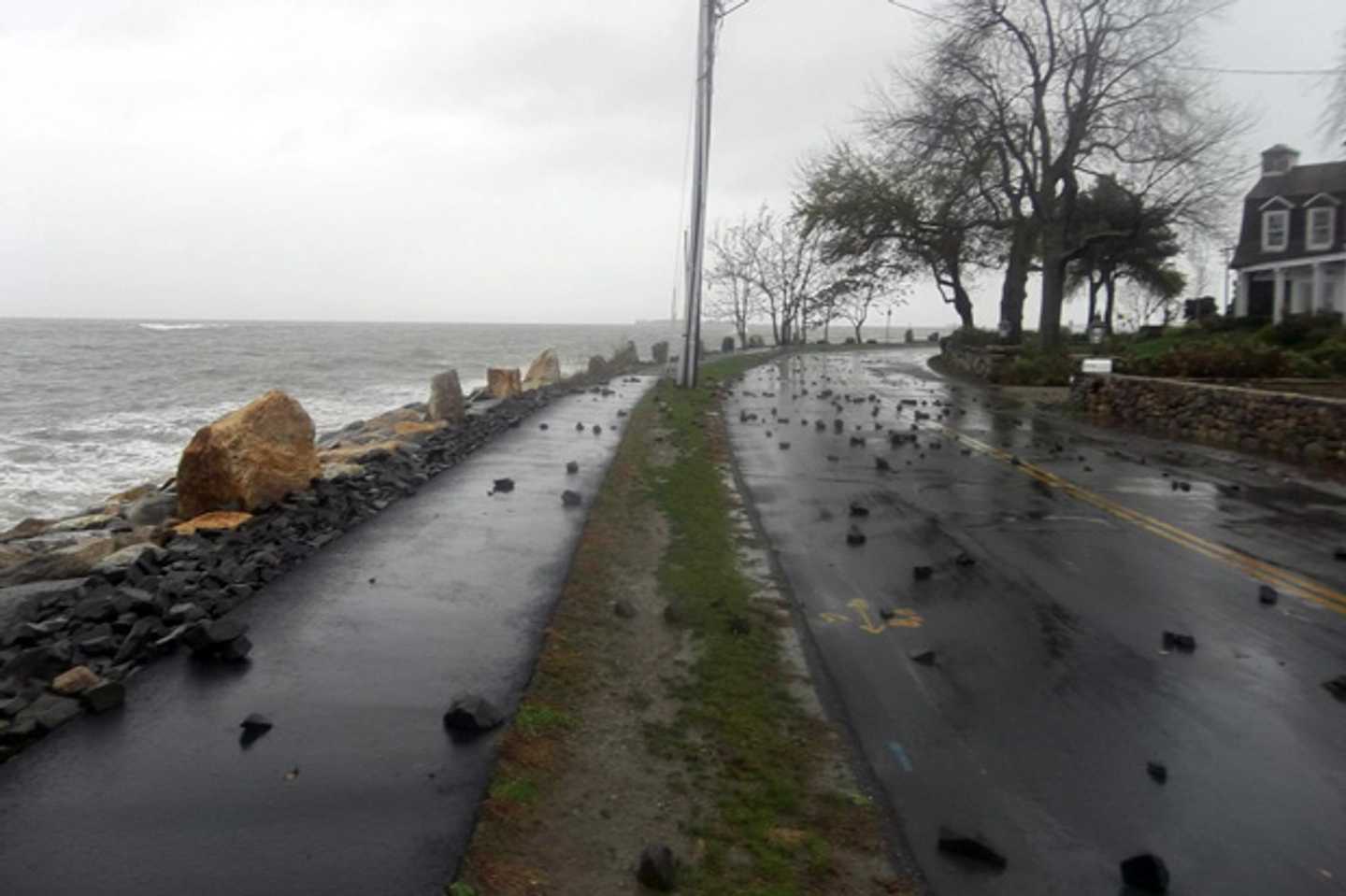
“Based on Hermine’s current projected path, we do not believe it will have a major impact on the state, but it does have the potential to produce some gusty winds and minor to moderate coastal flooding, especially in low-lying areas along the shoreline.
"Power outages are also a possibility with this storm. This storm needs to be watched closely over the next three to four days.”
Coastal Connecticut is already under a Tropical Storm Watch, along with coastal areas in New York, New Jersey and Long Island, according to the National Weather Service.
Sustained tropical storm force winds are possible on the coast with gusts inland.
Hermine could also cause a significant storm surge of 2 to 4 feet with moderate to major coastal flooding from high tide on Sunday and onward.
Dangerously rough surf and a life-threatening rip current is also expected this weekend out on Long Island Sound.
Rainfall of 1 to 3 inches is possible, with higher amounts locally.
Potential impacts include washed-out or flooded roads near the shore; severe beach erosion; damage to marinas, docks, boardwalks and piers; and small craft broken free from moorings.
Residents should prepare for Tropical Storm force winds of 39 to 57 mph, which could cause damage to roofing, porches and awnings; downed trees and branches, and power outages.
Hermine is expected to weaken from hurricane strength as it moves up the East Coast, but meteorologists are still expecting heavy rains, strong winds and potential coastal flooding on Labor Day and into Tuesday.
The potential impacts of the storm will vary greatly depending on the final track of Hermine.
Gary Lessor, a meteorologist at Western Connecticut State University in Danbury, told the Daily Voice that the storm will weaken as it moves north .
“It’s not going to take too long for it to dissipate back into tropical storm status," said Lessor, who is assistant to the director of Meteorological Studies at WestConn. “We are looking for the bulk of everything to stay to our south.”
The Connecticut Department of Emergency Services and Public Protection’s Division of Emergency Management and Homeland Security is monitoring this storm closely and is prepared to coordinate any potential state response.
DEMHS is participating in regular National Weather Service conference calls to get the latest information on the storm’s track and any potential impacts on the state.
Click here to follow Daily Voice Stratford and receive free news updates.