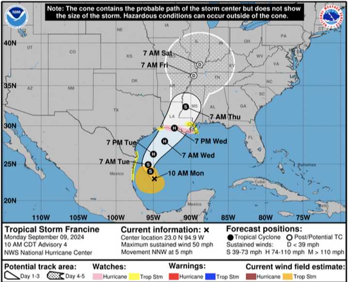
Francine, now located a few hundred miles south of the southeast Texas Coast, is expected was upgraded to a tropical storm late Monday morning, Sept. 9.
It's expected to become a Category 1 hurricane in the middle of the week.
For a look at the projected timing and path of the system, see the image above from the National Hurricane Center.
According to the National Hurricane Center, it has maximum sustained winds of 50 mph.
It's expected to move offshore of the northern Gulf Coast of Mexico through Tuesday, Sept. 10, and approach the US coastline on Wednesday, Sept. 11.
“The tropics were unusually quiet during much of August and over the Labor Day holiday weekend, but the historic lull seems close to officially ending,” AccuWeather Chief Meteorologist Jon Porter said. “It’s crucial that hurricane emergency kits and supplies that were used during Hurricane Beryl in July across parts of the Texas coastline, and kits yet unused in the Upper Texas Coast and across Louisiana are checked and restocked this week.
"People in the path of this storm need to be ready for the threat of flooding and power outages that could leave them without electricity and air conditioning.”
Check back to Daily Voice for updates.
Click here to follow Daily Voice Stratford and receive free news updates.
