

The storm will arrive in this region on Thursday night, Feb. 17 and continue into early Friday morning, Feb. 18.
“The highest winds gusts will arrive in areas from the Delmarva (Peninsula) to New York City early Thursday night before spreading into coastal southern New England later at night and into the early hours of Friday morning,” AccuWeather Senior Meteorologist Dean DeVore said.
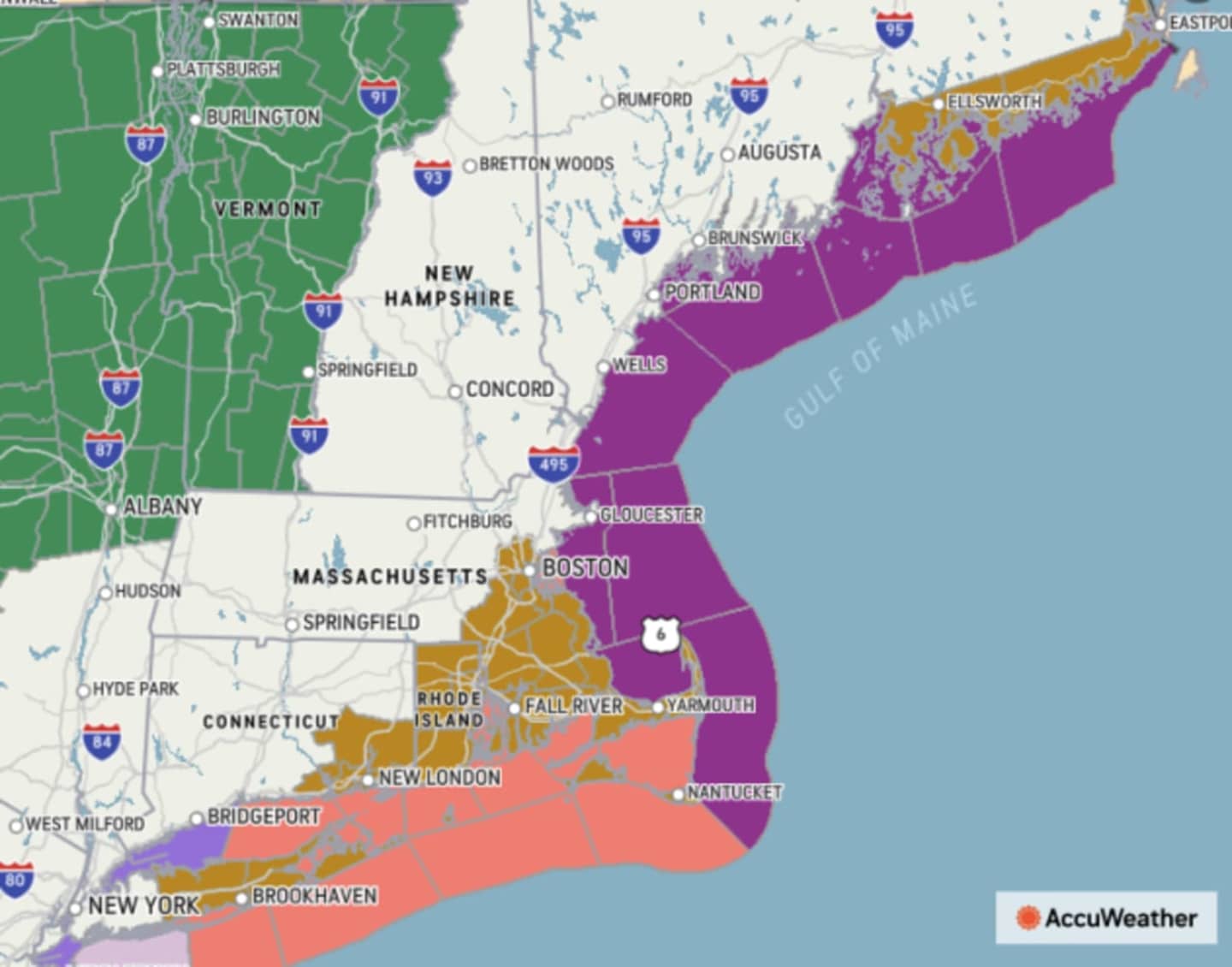
A Wind Advisory is in effect from late Thursday night into mid morning on Friday for the entire region. High Wind Watches have been issued for areas shown in gold in the first image above, including Long Island and eastern Connecticut. Areas where gale warnings have been issued are shown in purple.
The most powerful winds, with speeds of 25 to 35 miles per hour and gusts around 60 miles per hour, will be mainly near the coast, the National Weather Service said in a Hazardous Weather Outlook statement issued Thursday morning, Feb. 17.
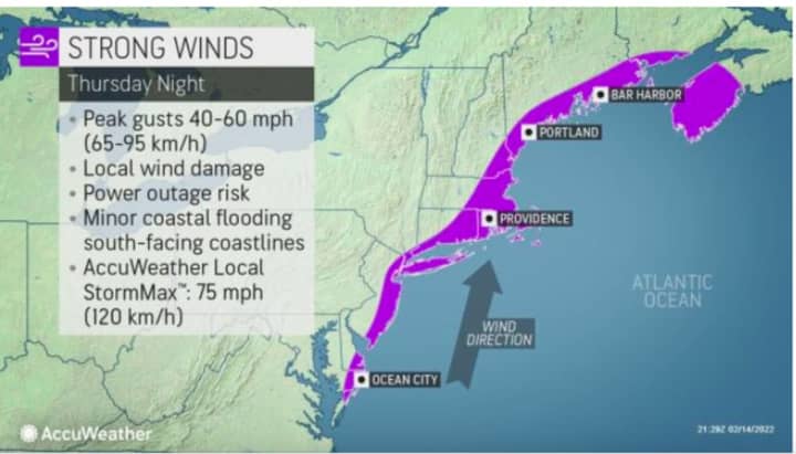
Areas where 40 to 60 mph wind gusts could cause power outages are shown in purple in the second image above.
For areas expected to see thunderstorms (green), heavy downpours (dark green), a mix of rain and sleet (pink) and snow (blue), click on the third image above.
The system will dump as much as a half-foot of snowfall to parts of upstate New York and northern New England. (Click on the fourth image above for projected totals.)
Thursday will be mostly cloudy during the day with the high temperature climbing into the mid 50s, with the potential for some spots in the area to record record highs near the 60-degree mark.
Rain could be heavy at times starting late Thursday night with scattered thunderstorms through the overnight hours as the powerful wind gusts whip through the region.
New precipitation amounts between three quarters and one inch of rain are possible before the storm winds down by mid-morning on Friday, the National Weather Service said.
Skies will gradually clear Friday, and the temperature will drop during the afternoon from a high in the mid to upper 40s to the mid 30s just before nightfall, with wind-chill values in the 20s.
It will be mostly clear overnight with wind-chill values in the teens.
Saturday, Feb. 19 will be breezy with clouds increasing and a high temperature in the mid 30s.
There is now a slight chance of snow showers from the late morning to mid afternoon on Saturday.
Check back to Daily Voice for updates.
Click here to follow Daily Voice Stamford and receive free news updates.