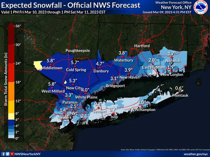
The time frame for the system is Friday night, March 10 into Saturday, March 11, according to the National Weather Service.
A widespread 4 inches of accumulation is now predicted for most inland areas, with close to 6 inches in some spots, where hazardous travel is expected. (See the image above from the National Weather Service.)
For New York City, Long Island, and coastal areas, a wintry mix is expected from the storm, but accumulations of 1 to 2 inches are possible.
Clouds will increase on Friday with a high temperature again in the mid-40s.
Precipitation could arrive as rain late Friday afternoon, before a changeover to a wintry mix late Friday evening, and snow in areas where the overnight low temperatures dip below the freezing mark overnight.
Wintry precipitation is then expected to continue at times until late Saturday morning before gradually ending.
Snowfall rates up to three-quarters of an inch per hour are possible from 10 p.m. Friday to 5 a.m. Saturday in interior areas, where the snow is expected to be wet and heavy.
Saturday will be cloudy with a high temperature of around 40 degrees.
Skies will clear overnight, leading to a mostly sunny day on Sunday, March 12 with a high temperature in the mid-40s before another potential snowmaking storm early next week.
Check back to Daily Voice for updates.
Click here to follow Daily Voice Newtown and receive free news updates.
