
El Niño is a large-scale ocean-atmosphere climate interaction linked to a periodic warming in sea surface temperatures across the central and east-central Equatorial Pacific.
It's resulted in warmer than average temperatures and below normal snowfall.
But it's still January, so we are bound to see at least one storm soon, right?
Seems likely, and there's a chance it could happen this weekend.
But before then, we will see partly sunny and very windy days through the end of the workweek. Wind gusts of 30 to 40 could bring down tree limbs and possibly some power lines, causing power outages, especially on Wednesday, Jan. 9 into Thursday, Jan. 10, the National Weather Service said.
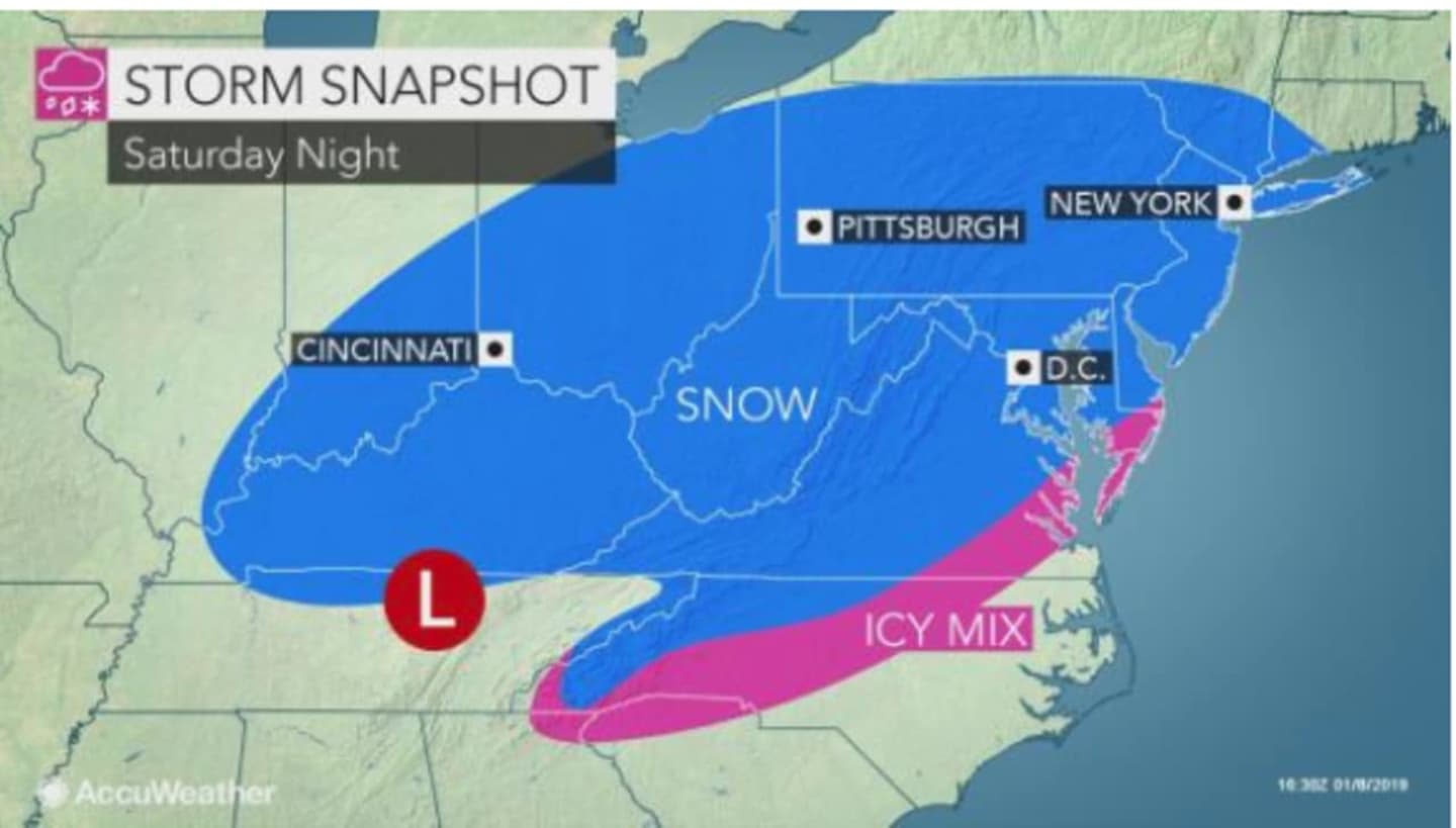
Toward week's end, a snowstorm developing in the Midwest will be heading East.
Saturday, Jan. 12 will be mostly sunny and cold during the day with the high temperature reaching only 30.
The current storm track has it scheduled to arrive in the tristate area late Saturday night.
The high temperature for Sunday, Jan. 13 will be just below the freezing mark, making conditions ripe for snow.
The strength of the storm will depend on its track as it reorganizes along the Atlantic coast, according to AccuWeather.com.
Check back to Daily Voice for updates on the storm's track and strength.
Click here to follow Daily Voice New Canaan and receive free news updates.