Dangerous, howling winds with damaging gusts will last throughout the day and into the evening on Monday, March 11.
Those winds, out of the Northwest between 20 to 30 miles per hour, will be accompanied by gusts up to 50 mph with the threat of scattered power outages.
Isolated gusts of up to 60 mph are possible.
"Gusty winds will blow around unsecured objects," the National Weather Service said. "Tree limbs could be blown down and a few power outages may result."
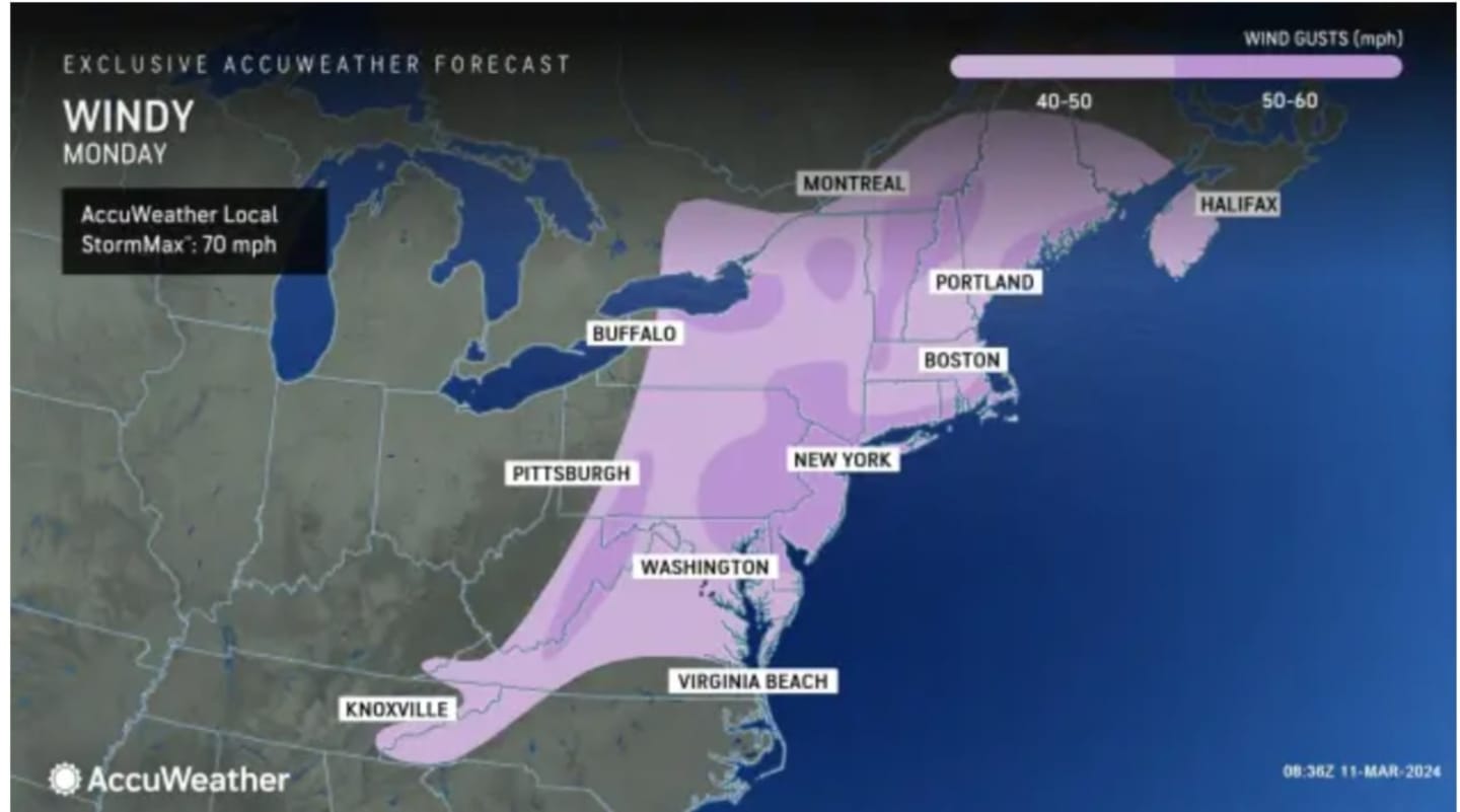
For areas where the strongest gusts are expected, see the image above from AccuWeather.com.
"The combination of wet soil conditions, thawed ground from the lack of cold this winter, and branches gaining weight from the flow of sap may increase the number of trees that topple," according to AccuWeather.com.
Clouds will gradually dissipate on Monday as the sun returns with some clouds amid the windy conditions, with a high temperature in the low to mid-40s.
Tuesday, March 12, and Wednesday, March 13 will be mainly sunny with temperatures in the low 50s to mid-50s.
There will be milder temperatures on Thursday, March 14 with the high expected to hit or climb just above the 60-degree mark in most of the region amid mostly sunny skies.
Unsettled weather will return on Friday, March 15, with mostly cloudy skies and scattered showers from mid-morning to mid-afternoon. The high temperature will again be around 60 degrees.
Check back to Daily Voice for updates.
Click here to follow Daily Voice New Canaan and receive free news updates.