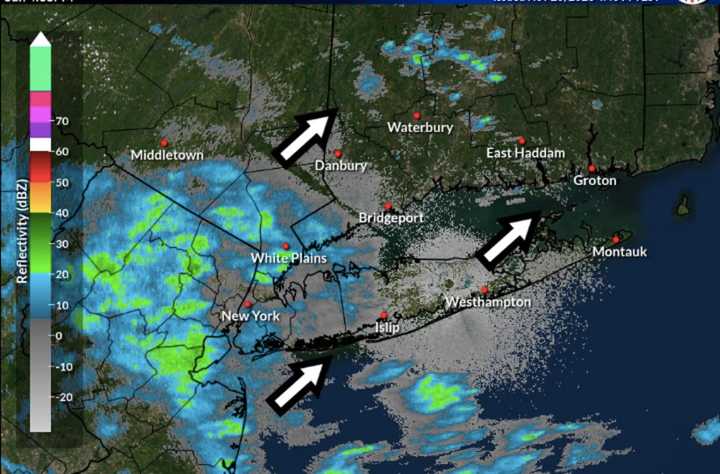
People traveling "should be prepared for possible delays both on roadways and in the air due to the wet weather on Sunday," according to AccuWeather.com, adding that motorists should be prepared for ponding on roadways and reduced visibility.
A widespread inch of rainfall is expected, with locally higher amounts of around 2 inches in some spots.
In northern New York and New England, snow will fall, with anywhere from 4 inches to a foot of accumulation possible, especially in northeastern NY and in the western Adirondacks.
Precipitation will wind down from west to east beginning after daybreak on Monday before finally tapering off in eastern New England later in the morning.
Skies will then gradually become partly sunny on Monday, and the high temperature will rise to around 50 degrees.
Tuesday, Nov. 28 and Wednesday, Nov. 29 will be mostly sunny, brisk, and breezy with a high temperature in the mid-30s both days.
The mercury will climb a bit on Thursday, Nov. 30 with the high reaching the mid-40s under mostly sunny skies.
Check back to Daily Voice for updates.
Click here to follow Daily Voice New Canaan and receive free news updates.
