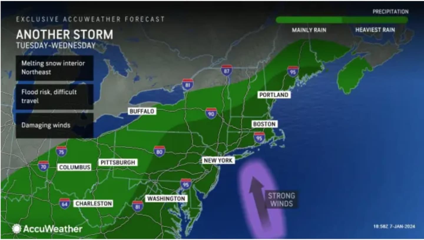


The storm, which is being labeled as a "multi-hazard event" by the National Weather Service, is expected to arrive late Tuesday afternoon, Jan. 9, and increase in intensity Tuesday night into Wednesday morning, Jan. 10. (Click on the first image above from AccuWeather.com.)
"There will be potential for widespread flooding, including flash flooding with nearly saturated grounds going into Tuesday night, allowing for excessive runoff," the National Weather Service said in a Hazardous Weather Statement issued Monday morning, Jan. 8.
Melting snow in areas where there were snowfall totals ranging from a couple of inches to a foot or more of accumulation, combined with heavy rainfall, is expected to compound flooding and lead to possible road and parkway closures.
In addition, wind gusts of 40 miles per hour and higher are expected, with gusts as high as between 60 to 70 mph in some spots. (See the second image above from AccuWeather.com.)
High wind and flood watches have been issued throughout the region.
It will be cloudy throughout the day Tuesday with a high temperature in the mid-40s. to low 50s farthest south.
Rain will become heavy Tuesday night with between 2 and 4 inches of rainfall possible into midday on Wednesday with breezy conditions lingering.
Rain will mix with sleet and snow in upstate New York and northern New England Tuesday night into Wednesday with generally 1 to 3 inches of snowfall accumulation expected, and up to 6 inches in some of those areas. (Click on the third image above for projections.)
Heavy rain is expected to wind down by around midday Wednesday, followed by a chance of showers, and then gradual clearing later in the afternoon.
Thursday, Jan. 11 will be mainly sunny with a high temperature will be in the mid-40s to low 50s.
The outlook for Friday, Jan. 12 calls for partly sunny skies with a high temperature in the mid to upper 40s.
Check back to Daily Voice for updates.
Click here to follow Daily Voice New Haven and receive free news updates.