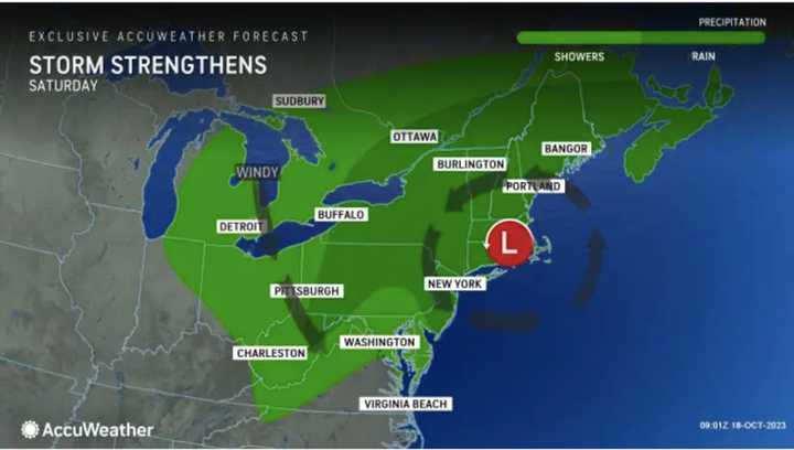
The current projected possible time frame for the potential Nor’easter is overnight Friday, Oct. 20, through Saturday, Oct. 21.
"Based on the latest information available, it appears that the worst of the storm and its impacts will be focused north of New Jersey and Pennsylvania with New York City and southern New England on the southern edge of the heaviest rain," according to AccuWeather.com.
According to the National Weather Service, it will be mostly cloudy on Wednesday, Oct. 18, followed by a mix of clouds and sun on Thursday, Oct. 19. The high temperature will be in the low 60s each day.
Ahead of the arrival of the weekend system, Friday will be cloudy with a high temperature in the mid-60s and showers becoming likely starting in the mid-afternoon.
The system is then expected to move through overnight Friday into Saturday, with rain heavy at times, and gusty winds.
The storm should wind down overnight Saturday into Sunday, Oct. 22, which will gradually become partly sunny.
Some uncertainty remains surrounding the track, timing, and strength of the weekend storm system.
Check back to Daily Voice for updates.
Click here to follow Daily Voice New Haven and receive free news updates.
