Storm activity that began in the middle of the afternoon on Friday, Aug. 2 will continue through the evening.
"Storms will produce locally heavy rainfall that could lead to isolated to scattered instances of flash flooding," according to the National Weather Service. "A few stronger storms could produce strong to damaging wind gusts."
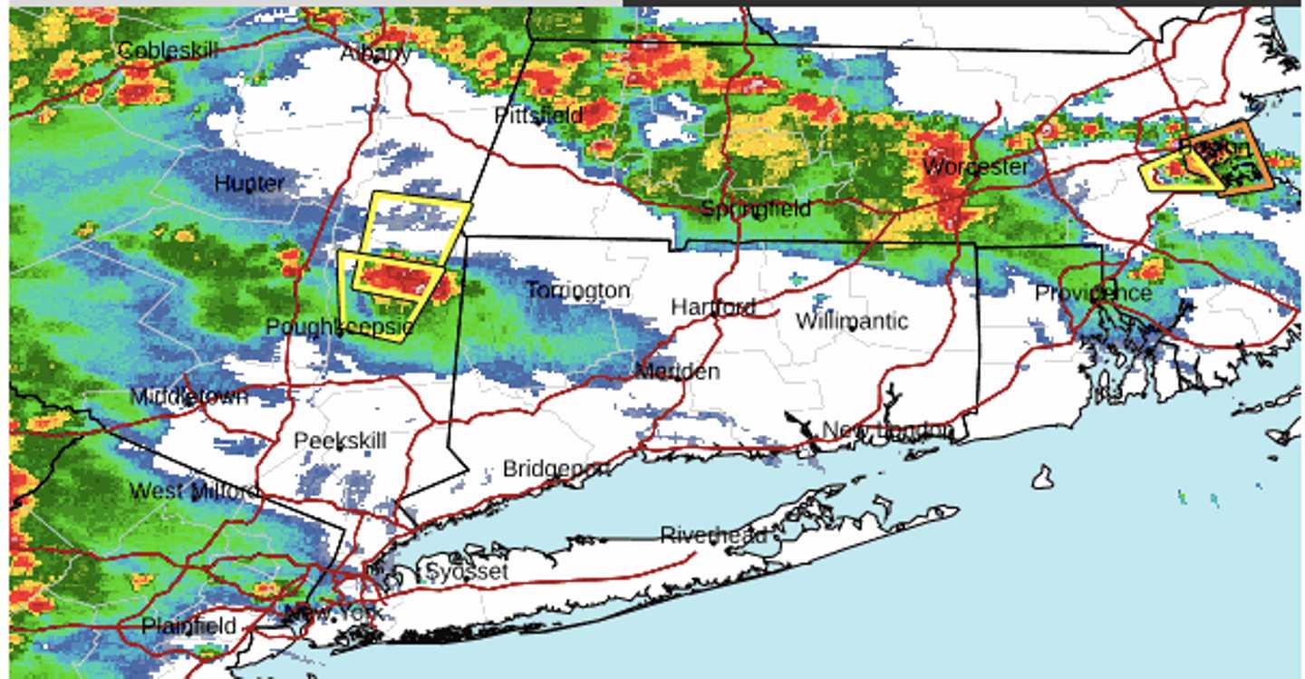
A radar image of the region above just before 5 p.m. Friday, Aug. 2, shows storms moving through from west to east, with severe storms marked in red.
Saturday, Aug. 3 will be another hazy, hot, and humid day with a high temperature around 90 degrees and heat index values as high as 99.
There will be a mix of sun and clouds with a new chance of afternoon and evening thunderstorms.
It won't be quite as hot Sunday, Aug. 4 with high temps in the mid-80s with mostly cloudy skies.
Afternoon showers are likely and scattered storms are also possible.
Check back to Daily Voice for updates.
Click here to follow Daily Voice Hartford and receive free news updates.