The watch, which went into effect at 5:30 p.m. Sunday, was issued by the National Weather Service for the Stamford-Norwalk-Bridgeport area.
The Tropical Storm Watch is also in effect for coastal New Haven County and all of Middlesex and New London Counties as well as southern Westchester County in New York.
A Tropical Storm Watch means tropical storm wind conditions are possible within the area in the next 48 hours.
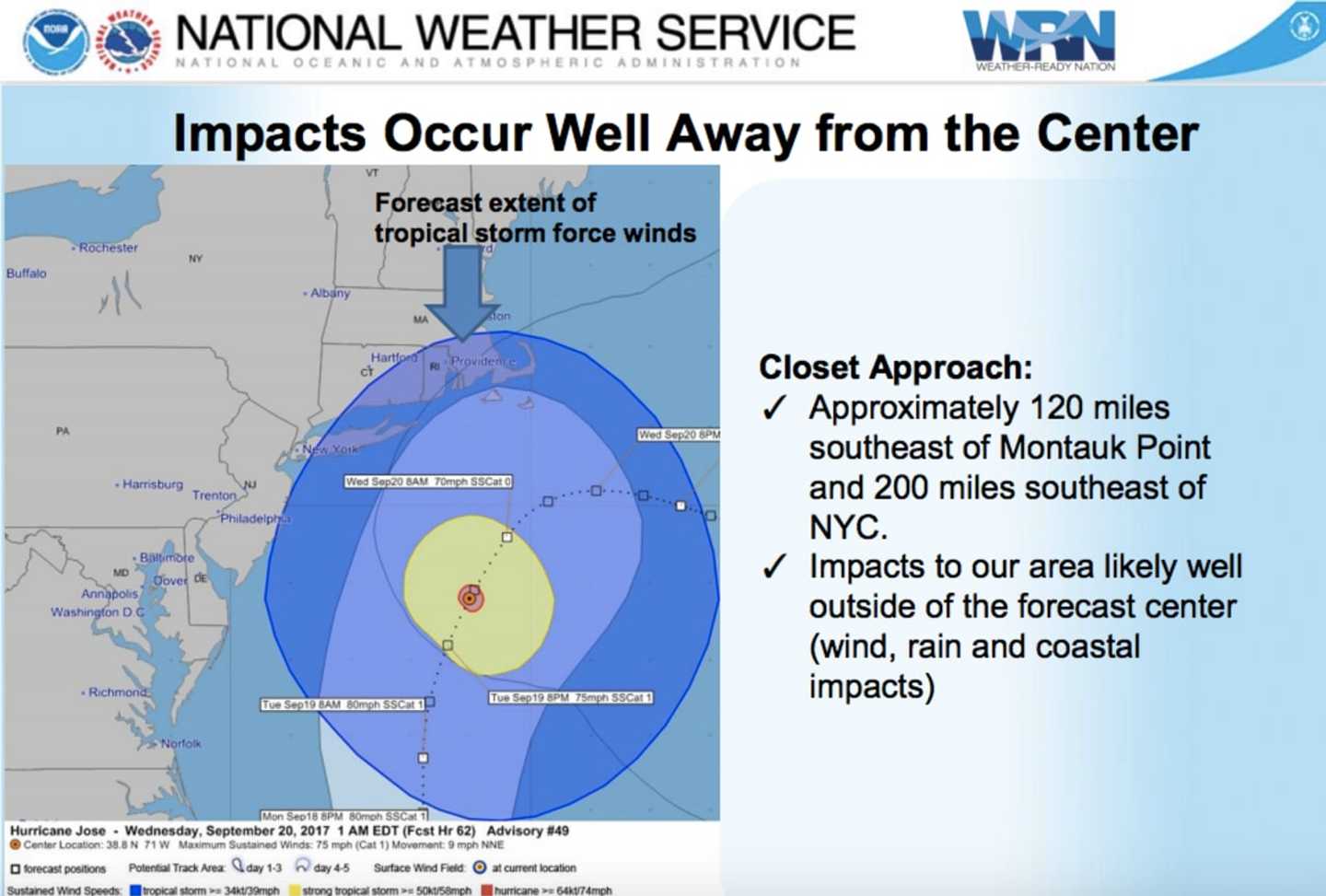
The eye of Jose is expected to be about 120 miles southeast of Montauk Point on eastern tip on Long Island at 1 a.m. Wednesday. (See chart above.) But Jose could impact coastal Connecticut on Tuesday with rough surf at beaches, rain and possible flooding in low-lying areas.
Although no more than one inch of rainfall is expected for Jose, now a Category 1 hurricane, the Tropical Storm Watch warns of impacts from gusting winds.
The peak wind forecast calls for winds of 25 to 35 mph with gusts to 45 mph. Winds of 39 to 57 mph are possible.
Residents should secure items on their property. Damage to porches, awnings, carports, sheds, and unanchored mobile homes is possible. Unsecured lightweight objects could be blown about. Large tree limbs could break and cause power outages, said the National Weather Services.
Some fences and roadway signs may be blown over and a few roads may be impassable from debris, the advisory also says.
Hazardous driving conditions on bridges and other elevated roadways and scattered power and communications outages are also possible.
For the latest National Weather Service briefing on Jose, click here.
Click here to follow Daily Voice Danbury and receive free news updates.