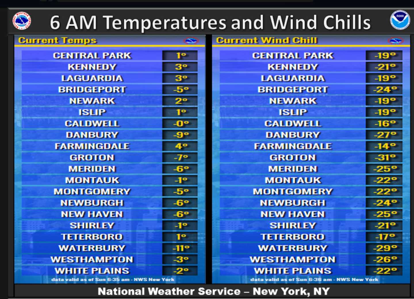
Temperatures on Sunday morning ranged from -9 in Danbury, with wind chills of -27, to -5 in Bridgeport, with wind chills of -24, according to the National Weather Service. New Haven and Meriden posted a low of -6, with -25 wind chills, and Waterbury hit -11 with wind chills of -29.
The previous record low for Valentine’s Day in the Bridgeport area was 3 degrees, set just last year.
The low in Central Park in Manhattan hit -1, the coldest Valentine's Day in New York City in 100 years and the second-coldest ever.
The bitter cold temperatures, couple with strong, gusty winds, are resulting in life-threatening wind chills as low as -20 to -35 degrees.
A Wind Chill Warning remains in effect through noon Sunday.
Hazards include extreme and dangerous cold; frozen pipes, frostbite and hypothermia.
The National Weather Service advises residents to wear layers, including hats and gloves; bring pets indoors; and to heat homes safely and only with indoor-approved devices.
High temperatures may hit 12 degrees under sunny skies, but wind chill values will remain between -15 and -25 with winds of 8 to 13 mph.
Sunday night will be mostly clear, with a low of about -1.
Snow is likely on Monday, mainly after 3 p.m., with a high near 32 and wind chills of 5 and 15. The chance of precipitation is 70 percent, but only about an inch of snow accumulation is expected.
Snow and freezing rain will continues Monday until 3 a.m., with rain afterward, according to the National Weather Service. New snow accumulation of 1 to 2 inches is possible with more ice and rain.
The high on Tuesday will be near 50, with heavy rain. A total of 1 to 2 inches of rain is possible, according to the National Weather Service.
Click here to follow Daily Voice Bridgeport and receive free news updates.