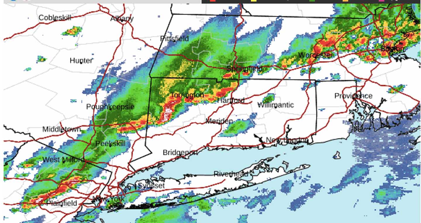
A radar image above from about 4 p.m. Sunday, Aug. 4, shows severe storms marked in red. Storm activity will continue until around 8 p.m., followed by a chance for scattered storms until late Sunday night.
The biggest threats are heavy downpours that could cause localized flooding and strong wind gusts that could bring down trees and limbs, leading to power outages.
About three-quarters of an inch of rainfall is expected, with locally higher amounts.
Gradual clearing overnight will lead to a bright sunny day on Monday, Aug. 5.
It will be hot, with high temperatures in the low 90s and heat index values in the mid-90s.
Clouds will increase at night as unsettled weather returns. There could be showers and scattered storms overnight.
Tuesday, Aug. 6, will be mostly cloudy, with showers becoming likely in the afternoon and storms possible from the early afternoon through around nightfall.
It won't be as warm with a high temperature in the low 80s.
Clouds will linger on Wednesday, Aug. 7, with a chance of showers during the day and again at night.
The outlook for Thursday, Aug. 8, calls for partly sunny skies, high temperatures in the mid-70s, and a chance for showers.
Check back to Daily Voice for updates.
Click here to follow Daily Voice Bridgeport and receive free news updates.