

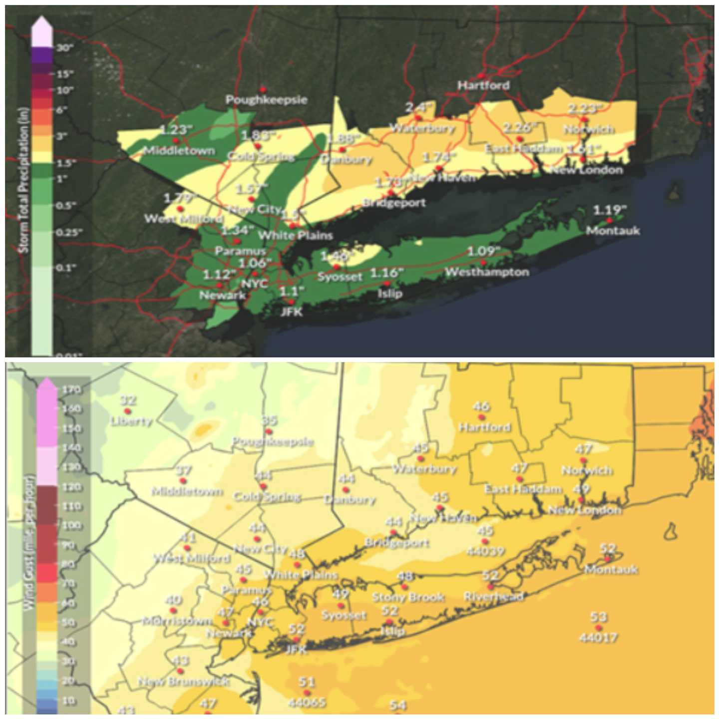
Nassau and Suffolk counties will both be under wind advisories due to the storm until 4 a.m. Tuesday, with National Weather Service meteorologists predicting isolated gusts up to 55 mph.
High winds are projected throughout the island, with maximum-strength gusts possible from Montauk to Riverhead to Islip and even just east of John F. Kennedy Airport, according to the National Weather Service.
“Gusty winds will blow around unsecured objects. Tree limbs could be blown down and a few power outages may result,” NWS forecasters wrote. “Locally damaging wind gusts possible with any thunderstorm activity this evening into tonight.”
At least an inch of rain is expected to fall across Long Island as well Monday night, according to meteorologists. While the island is predicted to get the worst of the wind, rainfall totals are likely to be even higher in other areas, triggering a flood watch in southern Connecticut.
“While storms will be moving rather quickly, moderate to locally heavy rainfall is possible in a short time, and minor urban and poor drainage flooding may result, and the entire area is [at] a marginal risk for excessive rainfall,” NWS forecasters said.
Coastal areas in southern Nassau County could experience minor flooding, according to the National Weather Service. Traditionally flood-prone areas, including around the western edge of the Great South Bay, face the biggest risk, but there is only about a 10% chance of notable flooding, forecasters said.
The storm is expected to clear out of the region quickly, with high pressure and colder temperatures arriving by Tuesday afternoon.
Click here to follow Daily Voice and receive free news updates.
