

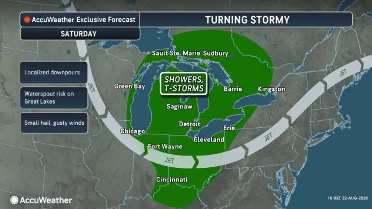


Showers and thunderstorms have started developing Saturday evening, Aug. 22, as the front and an accompanying area of low pressure push east from the Great Lakes.
The National Weather Service says showers will become more numerous overnight in parts of Pennsylvania, New Jersey, and New York. Some activity could continue into Saturday night.
Around New York City and northeastern New Jersey, the National Weather Service puts rain chances near 60 percent Saturday evening, with higher rainfall amounts possible where thunderstorms develop. Parts of southern New Jersey face even higher chances of rain.
Farther west, AccuWeather expects showers and thunderstorms to develop around the Great Lakes before the system advances toward the Northeast. Localized downpours, gusty winds, and small hail are possible with stronger storms.
The front will remain active Sunday, Aug. 23, bringing a broader area of damp weather from western Pennsylvania through New York and into New England.
AccuWeather says intense downpours could redevelop near the immediate coast and across New England as the system shifts east. The corridor from Washington, DC, to New York City has also faced an elevated risk of flash floods after several areas were soaked earlier in the week.
National Weather Service forecasts show showers and thunderstorms becoming more likely again before midday Sunday in parts of New York, New Jersey, and nearby areas. It will be mainly dry farther south Sunday, including Maryland, and Virginia.
Rainfall will not be continuous, but heavier pockets could cause brief flooding in poorly drained areas.
A change follows the front.
Drier, less humid air should begin spreading into much of the region on Monday, Aug. 24, with sunshine returning in many areas. Highs will generally settle near 80 degrees, with cooler readings across parts of the interior.
AccuWeather says temperatures around the Great Lakes and interior Northeast could run 5 to 10 degrees below historical averages as the cooler air settles in.
Tuesday, Aug. 25, is expected to remain mostly sunny and comfortable across much of the Northeast.
Check back with Daily Voice for the latest updates.
Click here to follow Daily Voice and receive free news updates.
