-
by
Joe Lombardi
National Interest
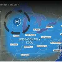
It may not feel that way, but summer is far from over.A stretch of cool, comfortable days will be followed by a return to more seasonable temperatures, according to the National Weather Service.The high will only be around 70 degrees on Wednesday, Aug. 21, after fall-like morning temperatures in the 50s. Some areas will see the mercury as much as 20 degrees lower than the seasonal ...
-

by
Joe Lombardi
Weather
One day of each weekend in the last six weeks has seen rain or showers.Get ready to make it seven in a row.But this weekend, that stormy pattern may kick it up a notch.Click here for a new, updated story: Chances Increase For Nor'easter Packed With Soaking Rain, Strong Winds: Here's LatestThat's because forecasters are eyeing the chance for a significant storm along the East Coast that ...
-

by
Joe Lombardi
Weather
A storm system headed to the region will bring heavy downpours at the tail-end of the weekend.Storm activity is expected Sunday afternoon, July 9 into Sunday evening, according to the National Weather Service.Between 2 and 3 inches of rainfall is expected in areas shown in darker green in the first image above from AccuWeather.com."This may result in flooding of urban, low-lying or poor ...
-

by
Joe Lombardi
Weather
A raw, wet start to the weekend will be followed by a dry day with plenty of sunshine on Sunday, March 26 before a new round of precipitation sweeps through the region.The high temperature on Sunday will range from the upper 50s to around 60 degrees, according to the National Weather Service.It will remain breezy with occasional 25-mile-per-hour gusts before winds subside in the ...
-
by
Joe Lombardi
Weather
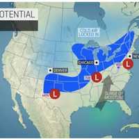
An unseasonable stretch of springlike temperatures will be followed by the arrival of a colder air mass that could bring a round of snowfall next week.The potential for snow could cover a stretch of about 2,000 miles, according to AccuWeather forecasters.In this region, the window for potential snow is overnight Tuesday, Nov. 15 into Wednesday morning, Nov. 16 in the areas shown in ...
-

by
Joe Lombardi
Weather
Pop-up storms will be possible amid hot, humid conditions this weekend before a more widespread system with the potential for much-needed drenching downpours sweeps through the region.High temperatures will be in the upper 80s to low 90s on Saturday, Aug. 20 under mostly sunny skies, according to the National Weather Service. Clouds will increase in the afternoon, and isolated showers ...
-

by
Joe Lombardi
Weather
Pop-up storms will be possible throughout the weekend as hot, humid conditions linger in the region.Skies will be partly sunny on Saturday, Aug. 6 with a high temperature in the upper 80s, but muggy conditions will make it feel like it's well into the 90s, according to the National Weather Service.The window for scattered storms Saturday will be from about 2 p.m. until 8 p.m.Sunday, ...
-

by
Joe Lombardi
Weather
An increase in humidity will help fuel a new round of widely scattered thunderstorms that will sweep through the region.The time frame for storm activity is mainly after 3 p.m. until around 11 p.m. on Thursday, July 28.Areas with the best chances to see storms are southern Connecticut and Long Island, according to the National Weather Service.Thursday will be partly sunny for most of ...
-

by
Joe Lombardi
Weather
An top-turvy weather pattern will see swings between periods of wet weather and clearing with some uncertainty as to what's in store on Mother's Day."A train of storms that is crossing the country this week will bring an unsettled stretch of weather to the Northeast, and AccuWeather meteorologists say the caboose of the storm train will end up putting a significant damper on at least ...
-

by
Joe Lombardi
Weather
The month of May has been mainly dry, but its final days will be far from it.Those last four days, of course, happen to cover Memorial Day weekend.According to the latest brand-new forecast, it won't be a complete washout, but it will be damp and dreary, wet and windy for much of the long weekend thanks to a slow-moving storm system.Friday, May 28 will be partly sunny and breezy for ...
-

by
Joe Lombardi
Weather
The calendar may say it's late May, but conditions will feel much more like the end of July this weekend.Temperatures will top out at around the 90-degree mark both days, with high humidity, and there will be multiple chances for isolated, spotty storms, some of which could be severe.Saturday, May 22 will be a mostly cloudy day with the storm chance starting in the early afternoon and ...
-

by
Joe Lombardi
Weather
A stormy weather pattern has arrived in the area, but things will brighten up for the weekend.It will bring scattered showers along with the chance for thunderstorms along with heavy rain and gusty winds.Thursday, April 29 will be cloudy and breezy with showers at times during the day. The high temperature will be in the low 70s.An isolated severe thunderstorm, with the threat of strong ...
-

by
Joe Lombardi
Weather
A new storm system will sweep through the region midway through the weekend, bringing heavy rain at times.Friday, April 23 will be sunny, blustery, and milder, with the high in the low 60s.There is an elevated risk of wildfire spread due to wind gusts up to 30 miles per hour and minimum relative humidity values between 20 and 30 percent, the National Weather Service said.Skies will stay ...
-

by
Joe Lombardi
Weather
A new storm will sweep through the area bringing rain, which could be heavy at times, as well as scattered snow showers, with some parts of the region seeing accumulating snowfall.The final day of February won't be a complete washout on Sunday, Feb. 28, but the rain is expected shortly after midday as the second storm system of the weekend arrives. It will continue through the evening ...
-

by
Joe Lombardi
Weather
It will be a wet weekend due to a pair of separate storm systems moving through the region.The first arrived overnight Friday, Feb. 26 into Saturday, Feb. 27, starting out as light snow, followed by a mix of snow and sleet before changing over to rain.There was about an inch or less of snowfall accumulation before the changeover.Rain is expected at times through early Saturday afternoon ...
-

by
Joe Lombardi
Weather
A stretch of dry weather will end with a rainy start to the weekend followed by two separate chances for snow, including a possible midweek Nor'easter.Here's the day-by-day outlook.Rain will arrive Saturday morning, Dec. 12, with patchy fog at times. The high temperature will be in the low 50s. Rain will taper off by late Saturday afternoon, followed by a chance of showers through the ...
-

by
Kristin Palpini
Breaking News
Freezing rain and frosty mornings are predicted for the weekend of Dec. 12-13 ahead of a developing snowstorm that could hit next week.The National Oceanic Atmospheric Administration is predicting a 70 percent chance of freezing rain and patchy fog early Saturday morning. More showers could fall in the evening. Temperatures may reach a high of 42 degrees.Sunday will be the more pleasant ...
-

by
Joe Lombardi
Weather
A potent, fast-moving storm system bringing downpours, gusty winds, and a mix of both light and heavy snow to different parts of the region is sweeping through, but the weekend will be far from a washout.In fact, after the system moves out in the early afternoon Saturday, Dec. 5, we'll see a big change in the weather pattern with skies clearing and the temperature dropping.Saturday ...
-

by
Joe Lombardi
Weather
Showers will linger during the morning following the latest storm system to move through the area, but it won't be long before a big change in the weather pattern coincides with the first day of summer.After those morning showers, accompanied by patchy fog before 9 a.m. on Friday, June 21, especially across eastern parts of the region, the weather will improve by the afternoon. It will ...


