-

by
Cecilia Levine
National Interest
With summer-like heat moving in, health officials have issued a Code Orange Air Quality Alert for much of New Jersey, New York, Connecticut, and the Philadelphia metro area on Wednesday, June 4 (scroll down to check your town's air quality index).The alerts, in effect from 11 a.m. to 11 p.m., warn that ground-level ozone pollution could reach unhealthy levels for sensitive groups, ...
-
by
Cecilia Levine
Weather
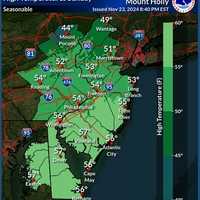
The National Weather Service in Mount Holly is forecasting a mix of sunny skies, mild temperatures, and rain chances this Thanksgiving week, with a potential coastal storm expected to impact travel plans Thursday into Friday.Here's your day-by-day forecast this week through the holiday, according to the NWS:Sunday, Nov. 24: Expect mostly sunny skies with a high near 56°F. West winds ...
-

by
Joe Lombardi
National Interest
A rare chance for rain and showers will be followed by a big change in the weather pattern at midweek.According to the National Weather Service, clouds will increase on Tuesday, Oct. 29, and temperatures will be in the low 60s.Rain and showers will move through Tuesday evening into the early morning hours of Wednesday, Oct. 30, with patchy fog overnight. Rain will be heavier farther ...
-
by
Cecilia Levine
National Interest
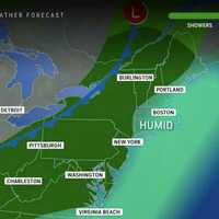
The last few days of summer are upon us. Here's how the weather patterns will play out Labor Day Weekend in the Northeast.The National Weather Service says Saturday, Aug. 31 will be mostly cloudy with scattered showers and thunderstorms possible around 6 p.m. "Humidity levels will build ahead of that front on Saturday and as that occurs, the risk of showers and thunderstorms will ...
-
by
Zak Failla
Weather
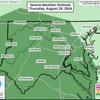
A Severe Thunderstorm Watch has been issued for parts of the DMV region as wicked weather is expected to roll through the region, forecasters are cautioning.Following a sweltering day, the National Weather Service is advising that parts of DC, Maryland, and Virginia may be subject to storms that may bring whipping winds approaching 70 mph and ping pong-sized hail to some areas.The Watch ...
-

by
Joe Lombardi
National Interest
It may not feel that way, but summer is far from over.A stretch of cool, comfortable days will be followed by a return to more seasonable temperatures, according to the National Weather Service.The high will only be around 70 degrees on Wednesday, Aug. 21, after fall-like morning temperatures in the 50s. Some areas will see the mercury as much as 20 degrees lower than the seasonal ...
-

by
Joe Lombardi
National Interest
There's more to come.After 4 to 6 inches of rain fell through much of the Northeast in the second half of the weekend, a new round of potentially powerful storms packed with drenching downpours aims for the region on the first day of the workweek.Additional precipitation of 1 to 3 inches is expected, with locally higher amounts, on Monday, Aug. 19. Rainfall rates of 1 to 2 inches in one ...
-

by
Joe Lombardi
National Interest
Numerous clusters of severe thunderstorms, heavy rainfall, and possible isolated tornadoes fueled by the remnants of Beryl are headed to the Northeast.Beryl, which made landfall along the Texas coast as a Category 1 hurricane on Monday, July 8, will move into upstate New York and northern New England on Wednesday, July 10, starting late in the afternoon and continuing overnight.The most ...
-

by
Joe Lombardi
National Interest
A powerful storm system that swept through the region has now pushed off the coast, leading to a dry and pleasant Father's Day weekend before the first potential heat wave of the year.Temperatures will soar into the 90s in much of the Northeast starting on Tuesday, June 18. The mercury is expected to hit 90 degrees or higher each day, possibly through the end of the workweek. A heat ...
-

by
Cecilia Levine
Weather
Sunday's spring-like weather was a lovely taste of what could be, but isn't — at least not yet.The Northeast is facing several days of rain before sunny skies return, forecasters say.Good Tuesday Morning Everyone! There will be three separate rounds of widespread rain this week. The first round is...Posted by US National Weather Service Philadelphia/Mount Holly on Tuesday, March 5, ...
-

by
Joe Lombardi
Weather
Pop-up storms will be possible amid hot, humid conditions this weekend before a more widespread system with the potential for much-needed drenching downpours sweeps through the region.High temperatures will be in the upper 80s to low 90s on Saturday, Aug. 20 under mostly sunny skies, according to the National Weather Service. Clouds will increase in the afternoon, and isolated showers ...
-

by
Joe Lombardi
Weather
Just when you thought there could be "snow" more, a new round of snow and rain showers is possibly on Tuesday, Feb. 23.But the temperature will be just above freezing during the window for precipitation from mid-morning to the early afternoon, so any snow will not accumulate on surfaces.Tuesday's high temperature could finally top the 40-degree mark under mostly cloudy skies.Then -- at ...
-

by
Joe Lombardi
Weather
There could be a new round of thunderstorms with drenching rain, strong wind gusts and flashes of lightning on Saturday, June 6.It will remain partly sunny into the early afternoon on another warm day in which the high temperature will be in the mid 80s.Then a cold front will approach from the northwest bringing a chance of showers and a few thunderstorms from about 2 p.m. until 6 ...
-

by
Joe Lombardi
Weather
Memorial Day Weekend will get off to a dreary start before skies clear and a bit of a warming trend starts.Here's the day-by-day forecast:Thursday, May 21: It will be a mostly sunny day with a high temperature in the low mid 60s.Friday, May 22: Clouds will thicken and the chance for showers will arrive after noontime on a day with a high temperature in the low 60s. Scattered rain and ...
-

by
Joe Lombardi
Weather
Drenching downpours are possible as an approaching cold front will bring a new round of thunderstorms to the area. Thursday, July 11 has started out partly sunny with high humidity of more than 80 percent -- conditions ripe for storms.Showers and thunderstorms will develop in the afternoon Thursday, becoming more widespread at night, with the potential for localized flooding.The high ...
-

by
Joe Lombardi
Weather
Thousands are starting the new month in the dark, despite the bright, sunny skies.That's because rounds of severe, isolated storms with fierce winds toppled trees, tree limbs and utility lines, causing tens of thousands of power outages throughout the region on Sunday, June 30.The storms were triggered by a cold front that has brought about a big change in the weather pattern as we head ...
-

by
Joe Lombardi
Weather
There's a big change coming following the first dry weekend of the spring.Here's what to expect, and when:Sunday, June 9: Mostly sunny skies will fade behind thickening clouds in the afternoon. Temperatures will be slightly cooler with a high in the mid 70s inland and low 70s along the coast. (See second image above.) There will be a calm breeze with winds between 5 to 8 mph.If you're ...
-

by
Joe Lombardi
Weather
A winter storm affecting more than 200 million Americans will sweep through the area, bringing accumulating snow and sleet and causing slippery travel conditions.A Winter Weather Advisory is in effect for the entire region from noon Wednesday, Feb. 20 until 6 a.m. Thursday, Feb. 21.Total snow accumulations of 2 to 4 inches and ice accumulations of a light glaze are expected. (See image ...
-

by
Karen Tensa
Weather
FAIRFIELD COUNTY, Conn. — The dangerous deep freeze is not over for Fairfield County. A Wind Chill Advisory has been extended until 8 a.m. Sunday for Fairfield County as well as most of Connecticut and the tri-state area. The very cold wind chills of 10 below zero to 20 below zero can cause frostbite in as little as 30 minutes to exposed skin. The high on Saturday will near 11 degrees — ...


