-

by
Joe Lombardi
Weather
The first half of the weekend will be dry before a storm system sweeps into the East, bringing soaking rain to the region.It will be mostly sunny and a bit cooler on Saturday, Oct. 26 with a high temperature around 60 degrees.Rain arrives overnight and will continue throughout the day on Sunday, Oct. 27.It will be cloudy and breezy with wind out of the southeast at around 10 miles per ...
-

by
Joe Lombardi
Weather
Now that the calendar has flipped to October, get set for some big changes, or to put it simpler: Weather whiplash.A summerlike stretch in the middle of the week will be followed by storms and rain which will lead to a drop to true, fall-like temperatures.Here's what to expect:Tuesday, Oct. 1: Mostly cloudy and more humid, with a high temperature in the low to mid 70s. There's a chance ...
-

by
Joe Lombardi
Weather
There will be a big change in the weather pattern after a stretch of comfortable and pleasant days.A surge of warm air and humidity will arrive later this week, serving as a reminder that it's still summer -- albeit late summer.Autumn begins on Monday, Sept. 23.We'll see dry and settled conditions in the area to start the week, as far north, Hurricane Dorian finally heads out to sea, ...
-
by
Joe Lombardi
Weather
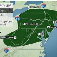
The storm system sweeping through the area is now expected to bring more rainfall than had been predicted.Generally, 1 to just over 2 inches of rain is forecast with locally higher amounts of as much as 3 inches in some spots. The bulk of the rain will fall during the afternoon and early evening hours on Tuesday, Aug. 13 on a mostly cloudy and humid day in which the high temperature ...
-
by
Joe Lombardi
Weather
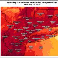
Get set for the most extreme days in the first heat wave of 2019 as power companies are bracing for a surge in energy consumption.An Excessive Heat Warning is in until 8 p.m. Sunday, July 21 with heat index values (the combination of the high temperature and humidity) up to around 110 degrees on Saturday, July 20 and around 105 degrees for Sunday.An Air Quality Alert is in effect from ...
-

by
Joe Lombardi
Weather
A powerful storm system with heavy downpours and damaging winds could cause power outages at the start of the new workweek.The storm system arrives with showers and thunderstorms at around 11 p.m. Sunday, April 14.Some of the storms could produce heavy rainfall, frequent lightning with areas of fog through the overnight."The storms will take on more of a squall line set up with the ...
-

by
Joe Lombardi
Weather
Click here for an updated story - Eye On The Storm: Heavy Rain, Gusty Winds Could Cause Power Outages A round of rain brought up to a half-inch of precipitation to the area overnight into early Saturday morning, April 13.While the rest of the day and evening will be rain-free, a more powerful storm system will sweep through the area overnight Sunday, April 14 into Monday, April 15.After ...
-

by
Joe Lombardi
Weather
The first full day of spring will see a strong storm system sweep through the East Coast, bringing heavy rain to the area and snow to upstate New York and northern New England on Thursday, March 21 into Friday, March 22.The heaviest rain will fall north and west of New York City, with between 1 to 2 inches expected with a half-inch to an inch near the coast, and lesser amounts farther ...
-

by
Daily Voice
Breaking News
Related story: Storm System Winds Down With Big Change In Weather Pattern Coming This WeekThousands are without power in Dutchess County at midday on Sunday as a storm that brought accumulating snow, sleet and freezing rain winds down.Just before noontime, 3,541 outages are being reported in Dutchess by Central Hudson Gas & Electric Corp. The estimated restoration time is 2 p.m. ...
-

by
Joe Lombardi
Weather
A quick-moving storm system has brought more freezing rain and sleet than snow in the area on Presidents Day morning.With temperatures hovering around freezing, motorists are urged to use caution until the Winter Weather Advisory expires at 10 a.m. on Monday, Feb. 18.There is a chance of rain late in the morning through the afternoon on a cloudy day in which the high temperature will be ...
-

by
Joe Lombardi
Weather
Projected snowfall totals have been released for a quick-moving storm system that will sweep through the area overnight Sunday, Feb. 17 into Presidents Day on Monday, Feb. 18.The expected accumulation amounts range from 2 inches farther south to 4 inches farther north with ice accumulations of a light glaze also expected. (See first image above.)For a look at areas (in purple) where a ...
-

by
Joe Lombardi
Weather
Click here for an updated story: Snowfall Projections Released For Quick-Moving Storm That Will Sweep Through Area A quick-moving storm system will sweep through the area, bringing accumulating snowfall to overnight Sunday, Feb. 17 into Presidents Day morning on Monday, Feb. 18.Saturday, Feb. 16 will be sunny, with a high near 40 and the wind-chill factor between 25 and 35. Skies will ...


