Tag: Northeast New Jersey
Flood Watch, Heat Advisory Issued For NJ As State Recovers From Deadly Storms
Just one day after a fast-moving storm swept through New Jersey, causing dramatic rescues, a home explosion, and multiple deaths, officials have issued both a Flood Watch and Heat Advisory for the region.
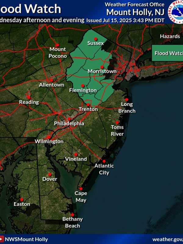
The Flood Watch, issued by the National Weather Service in Mount Holly, warns that flash flooding is possible in seven New Jersey counties from Wednesday afternoon, July 16, through late Wednesday night.
The counties include Sussex, Warren, Morris, Hunterdon, Somerset, Middlesex, and Mercer, affecting cities such as New Brunswick, Morristown, Newton, Flemington, Trenton, and Somerville, of…
New Forecast: Increased Snowfall Totals Expected, Arctic Temps To Follow Northeast Storm
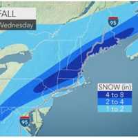
Newly-released forecast maps show parts of the region could see up to six inches of snow in the end-of-week storm.
Intermittent snow is expected to begin between 4 and 7 a.m. Friday, Jan. 19, with the heaviest amounts falling in the afternoon, the National Weather Service said.
Snow will fall at about 0.5 inches per hour and will taper by the evening, with temps in the upper 20s and low 30s, the NWS said.
SNOWFALL PREDICTIONS
The areas expected to get 4 to 6 inches are Trenton, Long Branch, Allentown, and Philadelphia. Reading, Vineland, Parsippany and Toms River are expected to get 3 to …
Hazardous Weather Outlook Issued By National Weather Service For Powerful Christmas Eve Storm
The National Weather Service has issued a Hazardous Weather Outlook statement for a powerful system that will sweep through the area on Christmas Eve, bringing drenching rain, thunderstorms, and damaging winds that could cause power outages.
The time frame for the storm is Thursday night, Dec. 24 into Friday morning, Dec. 25.
"The combination of lingering snowpack and heavy rain may bring flooding, with the highest potential across northeast New Jersey, the Lower Hudson Valley, and southern Connecticut," said the National Weather Service statement, issued early Tuesday mornin…
Stormy Sunday, Monday: Cold With Rainfall Up To 3 Inches, Coastal Flooding
Don't adjust your calendar.But it definitely does feel more like mid-February than mid-April, especially following a stretch of back-to-back days of true spring weather.
That trend will continue the next couple of days with heavy rain, possible thunderstorms, brisk winds and even the possibility of freezing rain in areas farther north.
The potential for pockets of freezing rain and drizzle into Sunday evening, mainly in higher elevations, is for Northern Westchester, Putnam Dutchess, Rockland, Orange, Northern Fairfield and Western Passaic. A glaze of ice accretion is possible.
A period of…