Tag:

Frequent Lightning

Ping Pong-Sized Hail, 70 MPH Winds Threaten North Jersey, Lehigh Valley Ping Pong-Sized Hail, 70 MPH Winds Threaten North Jersey, Lehigh Valley
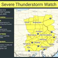
Ping Pong-Sized Hail, 70 MPH Winds Threaten North Jersey, Lehigh Valley A Severe Thunderstorm Watch is in effect until 8 p.m. Tuesday, May 6, for parts of New Jersey and Pennsylvania, the National Weather Service Storm Prediction Center said. Residents in Philadelphia, Trenton, Allentown, Reading, and across North and Central Jersey are impacted, the NWS said. “Isolated thunderstorms have developed over portions of the region,” the National Weather Service said in a Tuesday afternoon update. “The primary threat will be for hail and damaging winds across eastern PA and northern/central NJ.” Threats include: Scattered hail up to ping-pong ball size Wind gusts …
Severe Thunderstorm Watch In Effect For Much Of Region As Potent System Nears Severe Thunderstorm Watch In Effect For Much Of Region As Potent System Nears
Severe Thunderstorm Watch In Effect For Much Of Region As Potent System Nears A Severe Thunderstorm Watch is now in effect for much of the region as a potent system nears that will bring drenching rain, damaging wind gusts, hail, and frequent lightning. The watch went into effect Saturday, July 2 at 2:35 p.m. and lasts until 9 p.m. The main threat is damaging winds to 65 mph and hail to ping pong size, the National Weather Service said in a new update issued Saturday afternoon. See the first image above for areas where the watch is in effect.  As of 3:15 p.m., the watch area does not yet include the Capital District. Scattered showers and thundersto…
Severe Thunderstorm Watch Issued With 65 MPH Wind Gusts, 1-Inch Hail, Lightning Severe Thunderstorm Watch Issued With 65 MPH Wind Gusts, 1-Inch Hail, Lightning
Severe Thunderstorm Watch Issued With 65 MPH Wind Gusts, 1-Inch Hail, Lightning A Severe Thunderstorm Watch is now in effect as a potent system nears the region that will bring drenching rain, damaging wind gusts, hail, and frequent lightning. The watch went into effect Saturday, July 2 at 2:35 p.m. and lasts until 9 p.m. The main threat is damaging winds to 65 mph and hail to ping pong size, the National Weather Service said in a new update issued Saturday afternoon. See the first image above for areas where the watch is in effect. Scattered showers and thunderstorms will arrive mainly after 4 p.m. Saturday, and continue into the late evening. Up to a hal…
Severe Thunderstorm Watch Issued: Line Of Storms Moving West To East Severe Thunderstorm Watch Issued: Line Of Storms Moving West To East
Severe Thunderstorm Watch Issued: Line Of Storms Moving West To East With a line of storms approaching the region from the west, a Severe Thunderstorm Watch has been issued for much of the area. The watch lasts until 8 p.m. Thursday, Aug. 8 in Dutchess. The main threat from the line of storms is wind damage. Some of the storms will include torrential downpours, frequent lightning and thunder. Large hail is possible. A few storms may produce damaging winds, large hail and frequent lightning, the National Weather Service said. The stormy stretch ends on Friday, Aug. 9, which will be sunny and pleasant with a high temperature in the low 80s and less humi…
More To Come? There's A Chance For New Round Of Thunderstorms Before Big Change For Weekend More To Come? There's A Chance For New Round Of Thunderstorms Before Big Change For Weekend
More To Come? There's A Chance For New Round Of Thunderstorms Before Big Change For Weekend There will be a big change following the days-long unsettled weather pattern, but not before one more humid day in which thunderstorms are possible. Thursday, Aug. 8 will be partly sunny with a high temperature in the mid 80s and plenty of moisture in the air. There's a 30-percent chance for more storms, mainly after 2 p.m. Thursday, with the possibility for storms lasting through the evening. The highest probability for storms is between 8 p.m. and 11 p.m. Thursday. A few storms may produce damaging winds, large hail and frequent lightning, the National Weather Service said. The stormy …
Severe Thunderstorm Watch Issued For Area: Tornadoes, Hail Possible Severe Thunderstorm Watch Issued For Area: Tornadoes, Hail Possible
Severe Thunderstorm Watch Issued For Area: Tornadoes, Hail Possible A Severe Thunderstorm Watch is now in effect for the entire region with multiple rounds of storms accompanying a cold front that will move through the area. The storms will bring drenching rain, flash flooding, frequent lightning and damaging wind gusts, along with relief following the heat wave. Tornadoes and hail are also possible. (See the first image above.) Rain showers with embedded thunderstorms will develop and move across the area starting Monday afternoon and continuing through early Tuesday morning, July 23.  The Severe Thunderstorm Watch was issued just befo…