-

by
Joe Lombardi
Breaking News
Heavy rainfall from a powerful Nor'easter has ended, but damaging winds that could bring down trees, tree limbs and utility lines will continue as tens of thousands are already without power in the area.Downed trees have also caused numerous road closures throughout the region. A High Wind Warning is in effect through 6 p.m. Thursday, Oct. 17 for the counties shown in brown above, ...
-

by
Joe Lombardi
Weather
Major hurricane Dorian is expected to slowly approach the eastern Florida coastline late in the day on Tuesday, Sept. 3, before starting a days-long northerly trek that could affect the New York area with Tropical Storm-force winds at the end of the workweek.Dorian will remain a large and dangerous hurricane as the storm tracks northward near or just offshore the Florida east coast ...
-

by
Joe Lombardi
Weather
With rounds of strong thunderstorms now sweeping through, a Severe Thunderstorm Watch is now in effect until 9 p.m. Wednesday, Aug. 21 for the entire area. Be on the lookout for rapidly changing weather conditions into the evening, the National Weather Service said.The chance for storm activity will continue for several hours after the watch ends, until 1 a.m. Thursday, Aug. 22.During ...
-

by
Joe Lombardi
Weather
The storm system sweeping through the area is now expected to bring more rainfall than had been predicted.Generally, 1 to just over 2 inches of rain is forecast with locally higher amounts of as much as 3 inches in some spots. (See the first image above.) The highest amounts will be over New York City, Long Island and Coastal Connecticut. The bulk of the rain will fall during the ...
-
by
Joe Lombardi
Weather
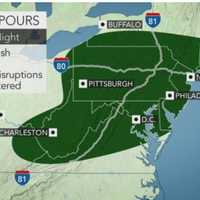
The storm system sweeping through the area is now expected to bring more rainfall than had been predicted.Generally, 1 to just over 2 inches of rain is forecast with locally higher amounts of as much as 3 inches in some spots. The bulk of the rain will fall during the afternoon and early evening hours on Tuesday, Aug. 13 on a mostly cloudy and humid day in which the high temperature ...
-

by
Joe Lombardi
Weather
The high-pressure system that resulted in a pleasant weekend will hang around for one more day before it gets stormy.Dry conditions and seasonable temperatures will continue on Monday, Aug. 12, which will be mostly sunny, a bit more humid but again pleasant with a high in the low 80s.A low-pressure system will then form along a frontal boundary that moves through.Tuesday, Aug. 13 will ...
-

by
Joe Lombardi
Weather
A picture-perfect stretch of dry and comfortable days will be followed by a new round of showers and heavy thunderstorms.The high-pressure system that resulted in a pleasant weekend will hang around for one more day before it gets stormy.Monday, Aug. 12 will be mostly sunny and again pleasant with a high in the low 80s.But then the high-pressure system will weaken and veer east, with a ...
-

by
Joe Lombardi
Weather
With a line of storms approaching the region from the west, a Severe Thunderstorm Watch has been issued for much of the area.The watch lasts until 8 p.m. Thursday, Aug. 8 in Dutchess.The main threat from the line of storms is wind damage. Some of the storms will include torrential downpours, frequent lightning and thunder. Large hail is possible.A few storms may produce damaging winds, ...
-

by
Joe Lombardi
Weather
There will be a big change following the days-long unsettled weather pattern, but not before one more humid day in which thunderstorms are possible.Thursday, Aug. 8 will be partly sunny with a high temperature in the mid 80s and plenty of moisture in the air.There's a 30-percent chance for more storms, mainly after 2 p.m. Thursday, with the possibility for storms lasting through the ...
-

by
Joe Lombardi
Weather
Click here for an updated story: Severe Thunderstorm Watch Now In Effect: Drenching Rain, Damaging Winds On WaySevere, gusty storms with damaging winds and drenching rain will roll through the area.Thunder, frequent lightning and local flash flooding are also expected, with large hail possible.Isolated storm activity will begin around 2 p.m. Wednesday, Aug. 7 on a mostly cloudy day in ...
-

by
Joe Lombardi
Weather
A round of strong thunderstorms could sweep through parts of the area on a warm and muggy day on Sunday, May 19.It will be partly sunny with a high in the low to mid 70s and an increase in humidity during the day. The storm system will arrive in the tristate area late Sunday afternoon, with strong thunderstorms possible late Sunday afternoon and evening, especially in areas north and ...
-

by
Joe Lombardi
Weather
A powerful storm system with heavy downpours and damaging winds could cause power outages at the start of the new workweek.The storm system arrives with showers and thunderstorms at around 11 p.m. Sunday, April 14.Some of the storms could produce heavy rainfall, frequent lightning with areas of fog through the overnight."The storms will take on more of a squall line set up with the ...


