-

by
Joe Lombardi
Weather
With a new round of storms moving from west to east, a Severe Thunderstorm Watch has been issued for much of the region.The watch is in effect until 11 p.m. Friday, Sept. 8 for southeastern New York and areas in western as well as coastal Connecticut. Potentially damaging wind gusts are the primary threat, with potentially damaging hail also possible, according to the National Weather ...
-

by
Joe Lombardi
Weather
A strong storm system packed with a mix of snow, sleet, and rain is moving from west to east through the region on Saturday morning, March 4.Areas south of the Interstate 84 corridor have seen mainly rain, with flooding in some spots, especially along the coast, where a widespread 1 inch of rainfall has fallen, according to the National Weather Service.Wind gusts as strong as 66 miles ...
-

by
Joe Lombardi
Breaking News
A new storm system that will move from west to east start in the evening on Super Bowl Sunday, Feb. 12 could bring rain and wintry precipitation to some parts of the region.The timing for the system is from early Sunday evening, Feb. 12 into just after daybreak on Monday, Feb. 13. Gusty winds are also possible in some spots during that time frame."Rain chances have been dialed back a ...
-

by
Joe Lombardi
Weather
After a one-day reprieve from the barrage of wintry weather on Wednesday, Feb. 17, a new storm taking aim on the region has the potential to dump a significant amount of snowfall.The time frame for the new storm is Thursday morning, Feb. 18 into Friday, morning Feb. 19, with the potential for moderate to heavy snowfall and a brief wintry mix, the National Weather Service said.A look at ...
-

by
Joe Lombardi
Weather
A quick-moving storm system arrived in the area just after daybreak on Tuesday, Feb. 9, bringing a mix of snow, sleet, and freezing rain to the area and creating hazardous driving conditions in parts of the region.A Winter Weather Advisory is in effect from 4 a.m. Tuesday to 1 a.m. Wednesday, Feb. 10 for the areas shown in the first image above.The highest snow will be during the ...
-
by
Joe Lombardi
Weather
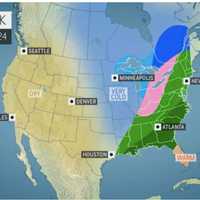
The National Weather Service has issued a Hazardous Weather Outlook statement for a powerful system that will sweep through the area on Christmas Eve, bringing drenching rain, thunderstorms, and damaging winds that could cause power outages.The time frame for the storm is Thursday night, Dec. 24 into Friday morning, Dec. 25."The combination of lingering snowpack and heavy rain may bring ...
-

by
Joe Lombardi
Weather
The arrival of a cold front will bring with it a quick-moving system that will be accompanied by scattered thunderstorms with damaging winds that could cause power outages.Small hail is also possible during the time frame for storm activity on Monday, May 11 from about 3 p.m. to 9 p.m.Clouds will thicken Monday morning in advance of the storm. The high temperature will be in the mid to ...
-

by
Joe Lombardi
Weather
Click here for an updated story: New Snowfall Projections Increase As Strong Winter Storm Approaches AreaBrand-new snowfall projections have been increased for the fast-moving winter storm that will create hazardous driving conditions over a broad area this weekend.The storm is expected to arrive early Saturday afternoon, Jan. 18 and wind down during Saturday evening. During that time, ...
-

by
Joe Lombardi
Weather
The storm system sweeping through the area is now expected to bring more rainfall than had been predicted.Generally, 1 to just over 2 inches of rain is forecast with locally higher amounts of as much as 3 inches in some spots. (See the first image above.) The highest amounts will be over New York City, Long Island and Coastal Connecticut. The bulk of the rain will fall during the ...
-

by
Joe Lombardi
Weather
It's a wet mess. And a windy one too.A storm bringing heavy downpours and strong winds between 20 and 30 miles per hour with gusts up to 50 mph is barreling through the area.Up to 2.5 inches of rainfall is possible before it winds down late in the afternoon.A Flash Flood Watch is in effect until 6 p.m. on Thursday, Jan. 24 for the entire area. A Coastal Flood Advisory has been issued ...
-

by
Joe Lombardi
Weather
Don't adjust your calendar.But it definitely does feel more like mid-February than mid-April, especially following a stretch of back-to-back days of true spring weather.That trend will continue the next couple of days with heavy rain, possible thunderstorms, brisk winds and even the possibility of freezing rain in areas farther north.The potential for pockets of freezing rain and ...
-

by
Joe Lombardi
Weather
Live Updates: School Closure Announcements For WednesdayThe storm system moving through the area overnight Tuesday into Wednesday is turning out to be pretty complicated.Early Tuesday night, the National Weather Service dropped Winter Weather Advisories across New York City and Southern Westchester, coastal Connecticut and portions of Northeast New Jersey as warmer air is expected and a ...


