

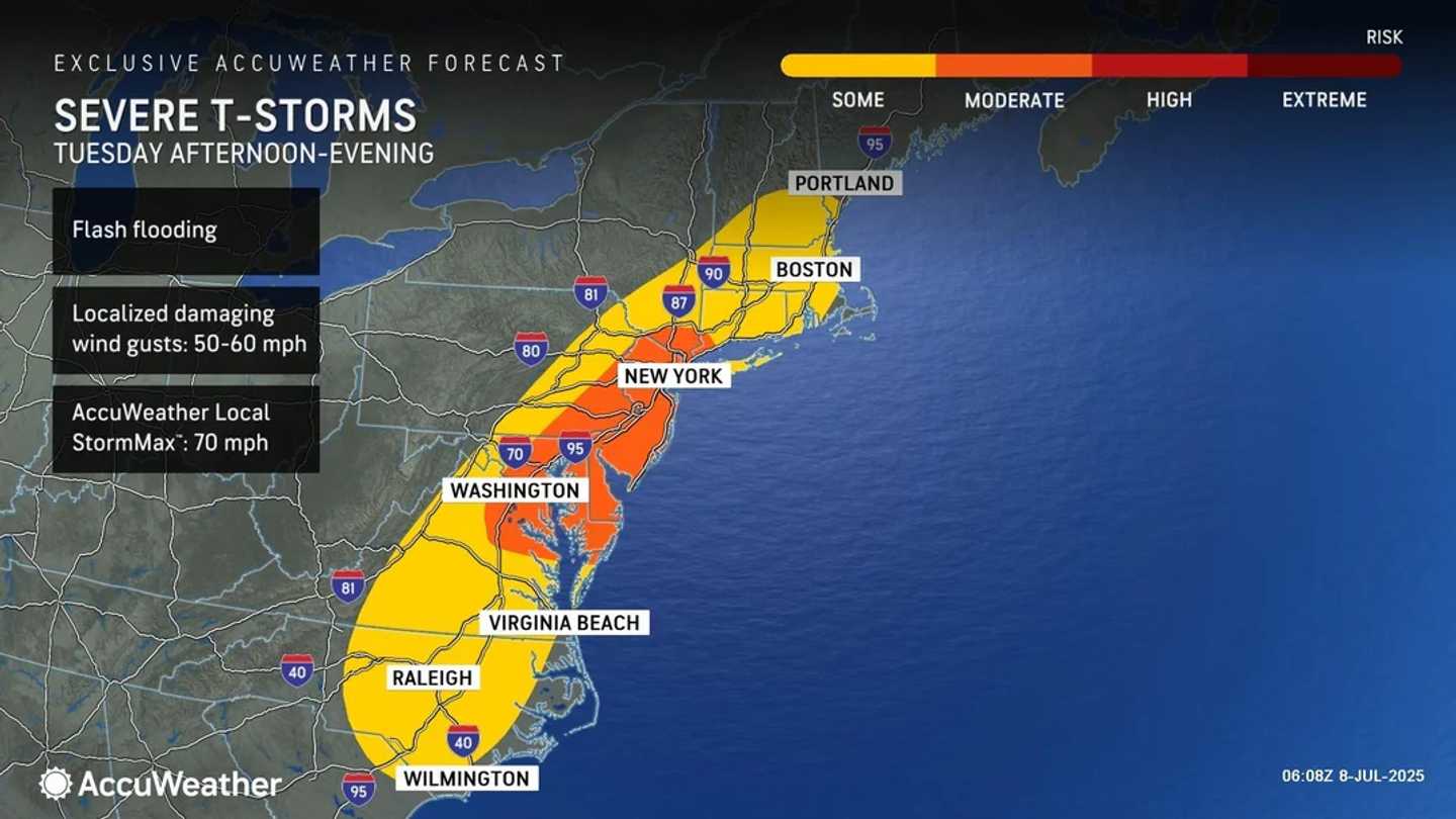


Forecasters say a daily pattern of pop-up storms and drenching showers will develop across the eastern US, continuing even after the remnants of Chantal move out to sea, according to the National Weather Service.
The most widespread activity is expected Tuesday, July 8, as heat and humidity combine with incoming atmospheric fronts to trigger thunderstorms from New England to the mid-Atlantic.
The most likely timeframe for storms is from until around 2 p.m. through the early evening.
The area between southern New York and northern Virginia is at particular risk, with AccuWeather meteorologists issuing a moderate severe weather outlook for that corridor. (See the image above.)
The main threat from the storms will be flash flooding, especially in areas that were already hit by heavy rain in recent days. Saturated ground and elevated stream levels could lead to rapid runoff and rising water in flood-prone zones.
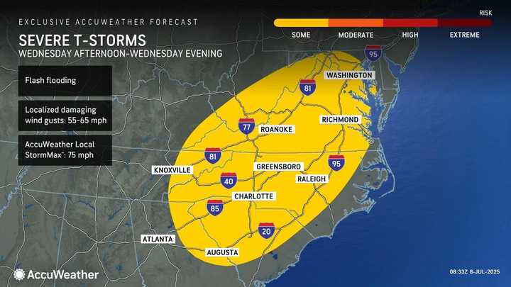
As the remnants of Chantal weaken, the chance for precipitation will decrease a bit on Wednesday, July 9, which will be partly sunny most of the day. Still, afternoon and evening thunderstorms are expected farther south. (Click on the second image above.)
It won't be as hot on Thursday, July 10, and Friday, July 11, but more storm activity is expected. (Click on the third image above.)
Check back to Daily Voice for updates.
Click here to follow Daily Voice and receive free news updates.
