

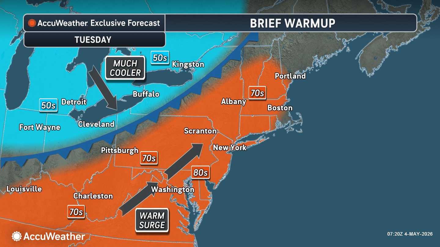


The latest shift begins on Cinco de Mayo, Tuesday, May 5, and will affect much of the region, including New York, New Jersey, Connecticut, Massachusetts, Pennsylvania, Maryland, and Virginia.
After a cooler weekend, temperatures will climb back to more seasonal levels before colder air arrives later in the week, according to the National Weather Service.
AccuWeather says the first half of May will run largely cooler than average across the Northeast, but not without quick warmups in between.
Its latest outlook shows a brief warm surge on Tuesday, with highs in the 70s for parts of Pennsylvania, New York, and New England. Highs in the 80s are possible from the Philadelphia and Baltimore areas toward Washington, DC.
That warmup will not last long.
"There will be a tease of warmer weather for many to start the week before a shot of chilly air rushes in for the end of the week," AccuWeather Senior Meteorologist Tyler Roys said.
The next weather-maker will be an advancing cold front moving from the central US toward the East, AccuWeather says.
The same front bringing severe weather risks to the South will also produce thunderstorms from northern Pennsylvania to Maine on Tuesday. Locally damaging wind gusts, hail, and even an isolated tornado are possible from thunderstorm activity, according to AccuWeather.
That means the storm risk will be highest north and west of the I-95 corridor at first, though showers and storms may still affect other parts of the region.
Wednesday, May 6, will stay relatively mild for many areas, but clouds and showers will increase as the cold front arrives overnight. Wind gusts will be 25 mph or more.
The bigger change arrives Thursday, May 7, as the frontal system crosses the region.
AccuWeather says severe thunderstorm risk will shift toward the East Coast by Thursday, with the main concern farther south along the Atlantic Coast, including parts of Virginia. Strong wind gusts and downpours will be the main threats there.
Behind the front, the temperature roller coaster will drop again.
From Thursday through Saturday, May 9, temperatures will run 5 to 15 degrees below historical averages. The chill is expected to be most persistent across the interior North, while the I-95 corridor may struggle to get out of the 50s late in the week.
The chilly pattern is expected to continue through mid-May, with wetter intervals in the East and unseasonably cool air over much of the region.
Check back with Daily Voice for updates.
Click here to follow Daily Voice and receive free news updates.
