

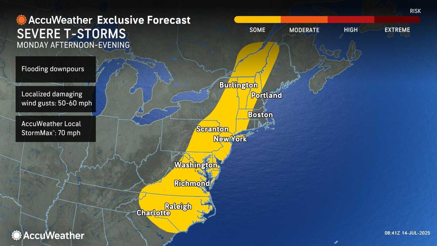

The first batch of storms will come on Monday, July 14, and is on track for the afternoon and evening along the I-95 corridor, including Washington, DC, Philadelphia, New York City and into New England.
"Rainfall rates of 2 inches or more per hour are possible with any repetitive thunderstorm activity," the National Weather Service said.
Damaging wind gusts are also possible.
A widespread 1-2 inches of rainfall is likely with localized rainfall totals of up to 3 inches possible.
"Much of this could fall in only three to four hours, causing isolated to scattered instances of flash flooding," the weather service said.
Monday will be cloudy throughout the day with high humidity.
Temperatures will be warm throughout the day with chances for more showers and storms each day through Friday, July 18.
"One issue with storms in the summertime is when they erupt, they can grow skyward and move very slowly at the same time--just like they do in tropical rainforests or jungles," said AccuWeather Senior Meteorologist Alex Sosnowski. This has the potential to unload a tremendous amount of rain."
Check back to Daily Voice for updates.
Click here to follow Daily Voice and receive free news updates.
