

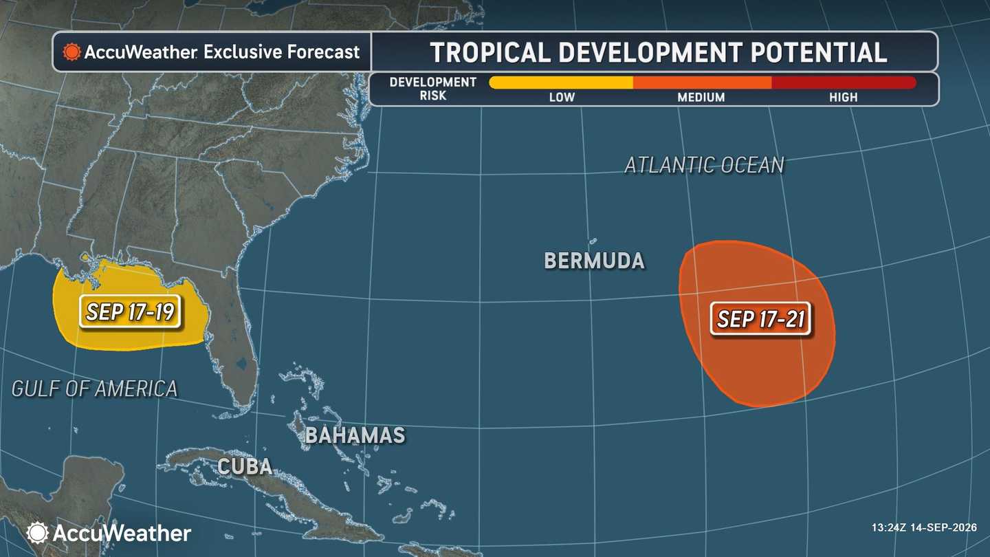


A low-pressure trough east-southeast of Bermuda is producing disorganized showers and thunderstorms, the National Hurricane Center said.
The system's seven-day formation odds have increased to 40 percent.
Conditions could become more favorable by midweek. A tropical depression may form late this week as the disturbance moves west-northwest slowly across the subtropical Atlantic.
The development window runs from Thursday, Sept. 17, through Monday, Sept. 21, according to AccuWeather.
Bermuda could experience downpours, squalls, and rough seas if the system organizes. No direct effects are currently expected in the Northeast or elsewhere along the US mainland.
AccuWeather now forecasts 1-3 hurricanes for the 2026 Atlantic hurricane season, down from the previous forecast of 3-4.
“We have never gone this late into the Atlantic hurricane season without a hurricane in the satellite era,” AccuWeather lead hurricane expert Alex DaSilva explained. “The strengthening El Niño is a major reason we are lowering our forecast again.
"Increasing wind shear has made it extremely difficult for storms to organize and strengthen, and we expect those conditions to become even less favorable as El Niño strengthens.”
Forecasters are separately watching a second potential development zone closer to the northern Gulf Coast.
No disturbance has formed there. However, a storm in the upper atmosphere may break away from the jet stream and move southwest across Florida later this week.
Wind shear and the system’s initial speed should prevent immediate tropical development. If it slows over the northern Gulf, it could begin organizing from Thursday through Saturday, Sept. 19.
A system forming that close to land could leave coastal communities with less time to prepare. Heavy rain, gusty winds, and rough surf would be possible even without substantial strengthening.
Neither area contains an organized tropical cyclone, and no Atlantic watches or warnings are in effect.
The activity comes during an extraordinarily quiet season. Only five named Atlantic storms have formed, and none has reached hurricane strength.
An average season produces four hurricanes by mid-September, AccuWeather said. If the basin remains hurricane-free through Monday, it could establish a record for the latest arrival of a season’s first hurricane.
Persistent wind shear and dry air associated with El Niño have suppressed development across much of the Atlantic.
The next two named storms will be Fay and Gonzalo.
The Atlantic hurricane season, which started Monday, June 1, runs through Monday, Nov. 30.
Check back with Daily Voice for the latest updates.
Click here to follow Daily Voice and receive free news updates.
